
Elevations of locations along our summer road trip route mapped and shown in a linear diagram (below). The labels get pretty small, so click to zoom and get the close-up view.
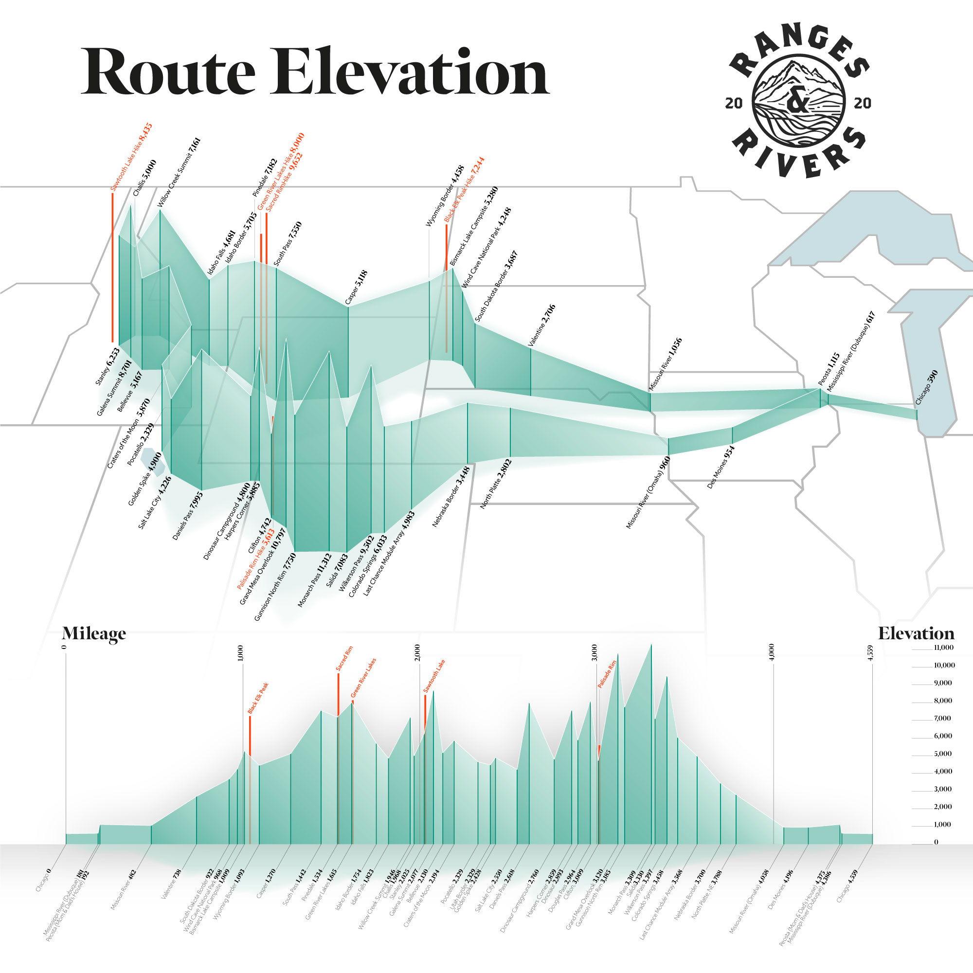
Elevations of locations along our summer road trip route mapped and shown in a linear diagram (below). The labels get pretty small, so click to zoom and get the close-up view.

You must be logged in to post a comment.