
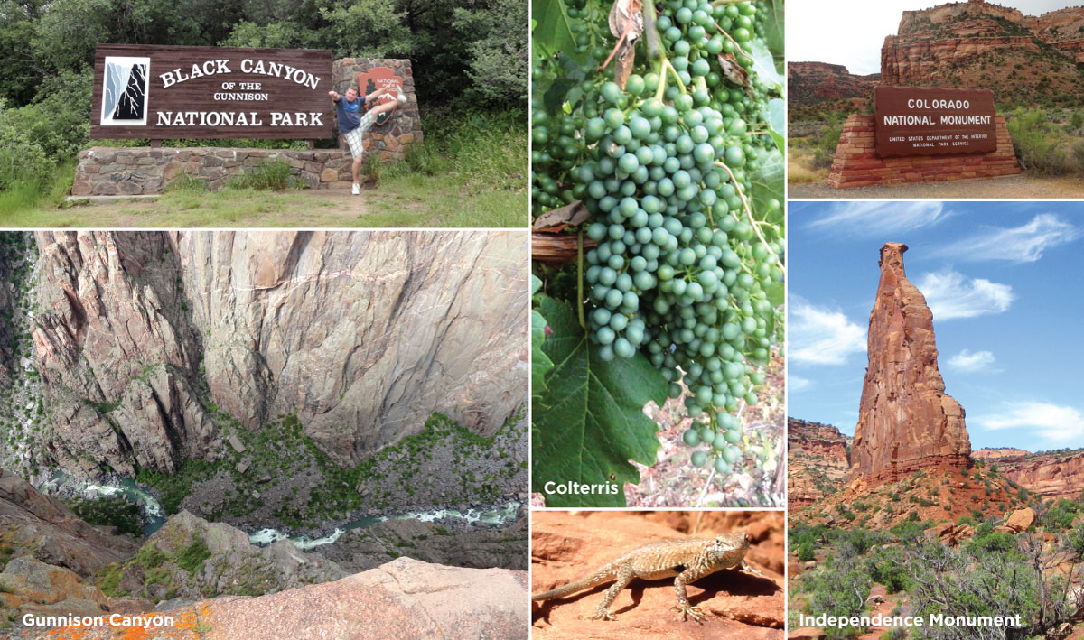
Our sixth national park of the trip, Black Canyon of the Gunnison, took us back into Colorado. To get there we decided to take a slightly longer but more scenic route. Instead of going north out of Moab to catch Interstate 70 to Grand Junction, we went south on US 191 and turned east on Utah 46 to skirt the scenic La Sal Mountains that had defined our eastern skyline for the past few days. This route meant we crossed into Colorado on a rather lonely stretch of roadway with beautiful surroundings. We wound our way through a broad valley between the Uncompaghre Plateau and the San Juan Mountains, turning north toward Montrose at the quaint-looking town of Ridgway. On a sad note, after more than 37,000 miles and 8 years of road tripping, we had our first roadkill incident along Colorado Highway 90 … sorry Mr. Ground Squirrel. Our arrival into Montrose brought the first sighting of suburban sprawl, strip malls and chain stores we’d seen in 11 days, and its population of 19,000 felt like a city in comparison to where we’d been. We were just getting the first hints of our civilization re-entry sequence. A quick TripAdvisor check led us to Horsefly Brewing for lunch. The quality of the beer and food belies the building’s apparent past life as a KFC franchise. The Highland Scottish was particularly good and there was no “Double Down” sandwich to be found on the menu.
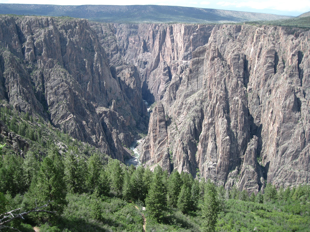
Black Canyon of the Gunnison from the Oak Flat Loop Trail.
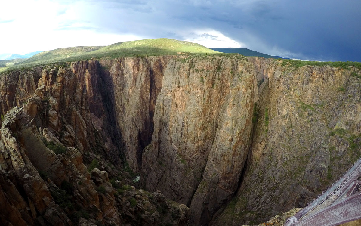
The Black Canyon of the Gunnison entrance station lies about 20 minutes northeast of Montrose after a long uphill climb. The park preserves the most scenic and dramatic 12 miles of the 48-mile long canyon carved through the Gunnison Uplift by the Gunnison River. Being off the beaten path and the 9th smallest national park by area, it is lesser known than the big Utah units we had come from. It was designated a National Park in 1999 after being a National Monument since 1933. The 2,000-foot deep canyon is notable for the extreme steepness of its walls and the name Black Canyon comes from the fact that parts of the deepest portion only receive about a half hour of direct sunlight a day. The steep canyon walls are due to the hardness of the rock the river is cutting through; they don’t easily crumble and widen the canyon horizontally like at Canyonlands. When the fast-moving Gunnison river got trapped in its current course after carving through softer volcanic rock, it began cutting straight down through layers of hard schist and gneiss at the rate of about an inch every 100 years. It’s a startling realization to note that you’re looking at the results of 2 million years of work. Today the Gunnison descends at an average rate of 34 feet per mile, one of the steepest rivers in North America. For comparison, the Colorado river drops about 7.5 feet per mile through the Grand Canyon. Standing at the rim, you can hear the water furiously rushing way down below, slowly deepening the channel. This source of water provided the motivation for the cultural aspect of the park. In 1901, the US Geologic Survey sent two men down the river to scout a suitable location for a diversion dam and irrigation tunnel to send water to the dry Uncompaghre Valley (around the town of Montrose) to develop agriculture. Earlier expeditions down the Gunnison had been disasters, but this attempt survived largely due to to their use of inflatable rafts rather than wooden boats, yikes. Their journey is covered extensively in the visitor center. Because of their findings, by 1909 the dam and a 5.8 mile tunnel were completed, helping to turn Montrose into an agricultural hub.
Just outside the South Rim Visitor Center, we hiked the 2-mile Oak Flat Loop Trail, that leads 400 vertical feet down along the canyon rim. That’s as far as you can go down unless you get a special backcountry permit to hike the inner canyon. Beyond a marked gate on the Oak Flat trail there are no maintained routes, just steep, rocky ravines descending into the depths. Anyone attempting this is expected to be in excellent physical condition, find their own way and be able to “self-rescue” in the event of trouble. There’s even a warning that due to the extreme terrain, some hikers who fell or became severely injured were never able to be “recovered”… so that little nugget should discourage most people from venturing in there.
The main park attraction is the scenic 7-mile South Rim Road and its vistas. Numerous lookout points are marked alongside the road, some with short trails that lead to spectacular views of the canyon and river. Gunnison Point, at the visitor center offered our first view of the water raging below. Down the road, Chasm View lookout is near the narrowest point where the North Rim is just 1,300 feet away. It feels as if you could throw a rock to the other side, but it would take more than two hours of driving to get there. The coolest view is probably at Painted Wall View, where Colorado’s highest cliff stands on the opposite side. It’s a sheer 2,250 foot wall of gray rock, with streaks of pinkish volcanic stone cutting through it.
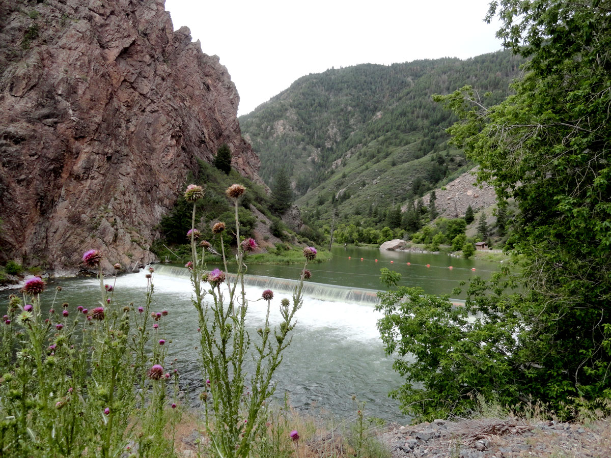
The historic Gunnison Diversion Dam.
At the end of South Rim Road at High Point, a 1.5-mile round trip trail leads to an overlook at Warner Point, but unfortunately once again there were storm clouds gathering and thunder rumbling nearby, so we thought it best to skip that and instead headed to the one place where you can access the canyon depths easily. Just inside the entrance station, a turn onto East Portal Road allows cars down to the river at the location of the historic Gunnison Diversion Dam and tunnel. The road plummets 1,966 feet over the course of 2.5 miles, twisting through hairpin turns the whole way. Our brakes smelled like a barbecue by the time we reached the bottom, even after crawling down slowly in 1st and 2nd gears. The perspective offered by looking up from the floor of the canyon is worth the trip, and we got to see the much talked-about diversion dam and the entrance building to the irrigation tunnel. After returning to the rim, we thought about making another attempt at Warner Point, but the weather was still threatening and sprinkles were falling, so we left the park and pointed toward our overnight stopping point, Grand Junction, Colorado.
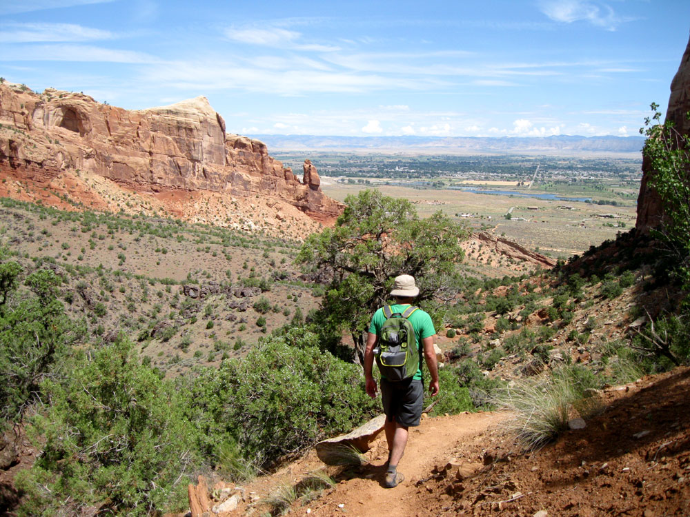
Descending through Wedding Canyon.
Our main motivation for stopping in Grand Junction was Colorado National Monument, which lies along the western edge of the city. We started our visit in the morning by hiking Monument Canyon Trail. The east trailhead starts strangely amongst suburban subdivisions, even passing just along the edge of people’s back yards before climbing gradually up a scenic canyon. About 2.5 miles in, the trail reaches the base of Independence Monument, a tall, thin remnant of a wall of rock that has been mostly eroded away. From this vantage point the high walls and other formations like the Kissing Couple tower overhead. The visitor center can also be seen clinging to the edge of the rim above to the north. The Monument Canyon Trail continues a further 3.5 miles and 600 feet up to the western trailhead along the scenic drive, but without a way to get back to the car, we instead made a loop by returning to our starting point via the unmaintained Wedding Canyon trail. Though it’s listed as “unmaintained” we found it easy to follow, and we always prefer seeing new scenery to doubling back on a trail. Hungry after the 5 mile hike, we stopped in the cute town of Fruita for a picnic lunch packed by Camilla’s Kaffe. Food in hand, we entered the scenic drive and passed through the double tunnels on the way to the top of the plateau. Between the finish of our hike and arrival at the visitor center with lunch, yet another pesky thunderstorm had popped up, blocking out the sun and rumbling ominously. We ate under a picnic shelter and watched the visitor center movie before continuing south along Rim Rock Drive. From viewpoints along this scenic road, we got the reverse view of our morning hike, looking down on the monuments and canyons instead of up from within. Monument Canyon View allowed us an overview of nearly our entire route, while the Coke Ovens Overlook provided a view of the mound-shaped rocks resembling industrial machinery. Further south along the scenic drive there are fewer prominent formations, but many sweeping views of red-walled valleys, before descending steeply to the east entrance. With the size and impressiveness of the monument, you may wonder why it’s not designated a national park. In fact, groups have been pushing for a status change intermittently for the past 100 years. A 2014 effort by members of Colorado’s congressional delegation proposed it becoming our 60th park and possibly being renamed Rim Rock Canyons National Park. Stay tuned, we may see this effort pass one of these years.

- Formations of Colorado National Monument. Independence Monument is at center left, brooding skies are above.

In early planning, our Grand Junction experience was going to be a quick drive-through on our way to Gunnison, but after learning of Colorado National Monument and area breweries and vineyards, we slightly re-routed our trip (taking the previously-mentioned southerly entrance into Colorado). We decided we would first visit Gunnison and then stay two nights in Grand Junction to explore the area. Hotel opportunities also played a part. Had we passed through Grand Junction, it would have put us overnight in Montrose, where there aren’t nearly as many hotels and restaurants. Our lodging for two nights was the Palomino Inn on the North Avenue strip. Grand Junction offers the standard list of chain hotels along Interstate 70 and some downtown options, but the Palomino has that independent motel vibe we enjoy. Additionally, it’s about half the price of the national chains, has more comfortable rooms and provided the best continental breakfast of our trip.
On the drive from Black Canyon, Nick searched for dinner options online. We were in the mood for some urban dining after our mostly rustic recent restaurant experiences, and found it at Bin 707 Food Bar downtown. Local specialties like Colorado lamb tenderloin highlight the dinner menu and a wide selection of creative cocktails and an extensive wine list is available. On our second night in town for dinner we went for Italian at il Bistro Italiano. There was a bit of a wait due to the lively Thursday farmers market happening on Main Street, but we killed the time browsing a nearby book shop. It was well worth the wait for the homemade bread and pasta and the unique takes on traditional Italian dishes.
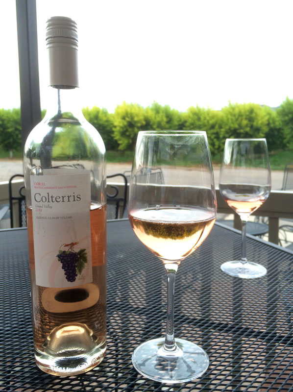 Before this trip, we were only vaguely aware of the existence of a Colorado wine country. Consisting of 50 square miles near Grand Junction, it is known as the Grand Valley AVA (wine region) and was established in 1991. A week earlier in Mesa Verde’s Metate Room we wanted to try a Colorado wine with dinner, so our server recommended a bottle from Colterris Wines. The vineyard is located just east of Grand Junction on a mesa overlooking the Colorado River near the town of Palisade, so we had to check it out. It’s only a 20 minute drive from the Palomino Inn, so right after returning from the national monument, we freshened up and headed over for some tastings. The grounds are beautiful, and there’s a store attached where you can sample and buy their fruit as well. We especially enjoyed the unique Coral White Cabernet Sauvignon, which is a white wine made from red grapes that has the color of a rosé. We bought a bottle to enjoy while watching storm clouds brew. Speaking of which, there is also a healthy amount of brewing going on in the Grand Junction region. After Colterris, we stopped by Palisade Brewing to check out the local beer scene. We were very happy with our findings, and enjoyed a couple pints in the metal shed-turned-brewery while rain poured down outside.
On our last morning in Grand Junction we stopped by Allen Unique Autos, a large car collection owned by a local businesswoman. It’s a quirky gathering of historic cars uniquely (tackily) displayed, but we had an hour to kill, so it was entertaining. We then proceeded east toward Denver, happy in our perfectly normal car.

You must be logged in to post a comment.