Western Parks Part 3: Between Mesa Verde and Capitol Reef

Part3

Continued from Part 1 & Part 2

ArrowMesa Verde and Capitol Reef National Parks are less than five hours apart if you go the fastest way, but there’s plenty to see in between, so we made it a two-day transit. The first stop was the Four Corners Monument, about an hour and a half from Far View Lodge. It’s the location where Colorado, New Mexico, Arizona and Utah meet, the only spot in the United States shared by four states. The Navajo Nation Parks and Recreation Department maintains the site and charges $5 per person for access (cash only). The exact meeting point is marked by a bronze disc surrounded by a large circular plaza with seating and flags of the states and native nations represented. Outside that is a row of market stalls where Native American artisans sell crafts. We expected Four Corners to be a bit of a tourist trap, but were pleasantly surprised. Most visitors wait in an orderly fashion to take photos of themselves in various positions touching all four states at once. We snapped a couple photos and then browsed around the shops. Aside from a couple t-shirt stands, the majority of the crafts on display are quality, handmade items, with many of the artists working right there while you watch. It’s a good place to pick up some authentic souvenirs and support local crafts men and women.

MonumentValleyKick
John Ford Point, named after the film director who helped make Monument Valley an icon of the American West.

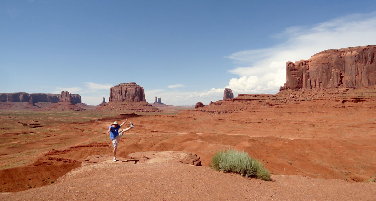
Continuing west another hour and a half brought us to the famous Monument Valley of Arizona and Utah. Admission is $20 per car for up to four people and $6 for each additional person. Like Four Corners, it’s run by the Navajo Nation so it doesn’t have quite the level of services, interpretive exhibits or programs expected from the National Park Service, but the scenery is truly unique. Giant sandstone buttes rise up to 1,000 feet from the valley floor all around. From the visitor center the famous “mitten buttes” are front and center. A 17-mile unpaved loop road is open to the public to get farther into the valley. It is very rough in places, making it a slow trip unless you’re in a large four wheel drive vehicle. Guided tours in open trucks would be a fun but dusty alternative to driving yourself. Temperatures were hovering right around 100 degrees when we were there on July 2, so any hiking was out of the question. The rock is red, the dirt is red and your car will be red after driving the road, but it’s a great way to get up close to the formations. Many Western movies were filmed with Monument Valley as a backdrop, helping making it he standard landscape people think of when they envision the American West. Director John Ford used the Valley for several of his films and now for $5 you can have your photo taken on a horse at John Ford Point (why did we not do that?). Our next lodging stop was just a half hour away in Mexican Hat, with the skyline of Monument Valley in the rearview mirror nearly the whole time. We’d later come back to this section of Highway 163 to watch the sunset.

When looking for lodging in sparsely populated areas, our normal urban go-tos like Hotwire and Hotels.com aren’t always useful. There is no significant town near Monument Valley, just the pricey hotel in the park, the large Goulding’s Lodge across the highway. A quick search on Google Maps revealed a cluster of reasonably priced lodging at a tiny dot on the map called Mexican Hat. It sounds like a joke, but it’s the town’s real name. It’s named after a rock formation along the highway that looks like an upside down sombrero (in retrospect Sombrero, Utah might have had a better ring to it). We selected the creatively named Mexican Hat Lodge because of its reasonable rates and the on-site restaurant, Swingin’ Steaks. The indoor pool furnished a refreshing dip and a French family of 5 that pulled in at the same time as us provided eavesdropping entertainment in the patio area. After viewing the sunset, we returned for dinner at the Swingin’ Steak. This is a restaurant that truly does one thing and does it well. Basically you just choose what cut of steak you’d like, your preferred temperature , and it comes with beans, salad and Texas toast on the side. Done. A man in a cowboy hat fires the steaks on a grill that swings like a pendulum, passing through the flames repeatedly until seared to perfection. We enjoyed the ambiance of the outdoor seating with a couple Polygamy Porter beers from Wasatch Brewery. If you’re like us, you’ll want to research ahead when traveling in Utah to make sure a restaurant has a liquor license.

Sombrero

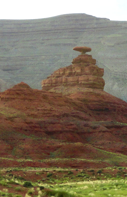
Mexican Hat’s sombrero.

Our day of travel between Mexican Hat and Capitol Reef National Park was a spectacular one. Some of the highlights were expected, but there were some surprises in store for us as well. We grabbed a light breakfast from a convenience store and headed out early, knowing we had a lot of stuff to see throughout the day. After passing the rock formation that gives Mexican Hat its name, we stopped just a few miles north of town to eat with a view at Goosenecks State Park. It is a small park with no real facilities other than an overlook and a few places to park campers, but there is a great view of a section of the San Juan River where it has doubled back repeatedly carving a series of switchbacks in a deep, narrow canyon. Speaking of switchbacks, we departed the park and turned northwestward toward our next planned stop, but after driving several miles across Valley of the Gods on Utah 261 we were pointing directly toward a seemingly impenetrable wall of rock. A sign warned us of “narrow gravel road next 3 miles” but we looked ahead and could not figure out where this road was taking us. Is there a tunnel? A sudden turn to the left? Nope, we had just come face to face with the Moki Dugway, which somehow went unnoticed in all our planning. Just before arriving at the base of Cedar Mesa, the highway degrades to a rough, dirt/gravel surface and begins climbing 1,200 vertical feet in a dizzying series of switchbacks. At the top there is a panoramic view of Valley of the Gods below and Monument Vally on the southern horizon. Turns out, the road was built by a mining company in the 1950s as a shortcut to get ore from the Mesa top to the processing plant near Mexican Hat. It’s a shortcut worth taking, but may be impassable in wet or snowy weather.

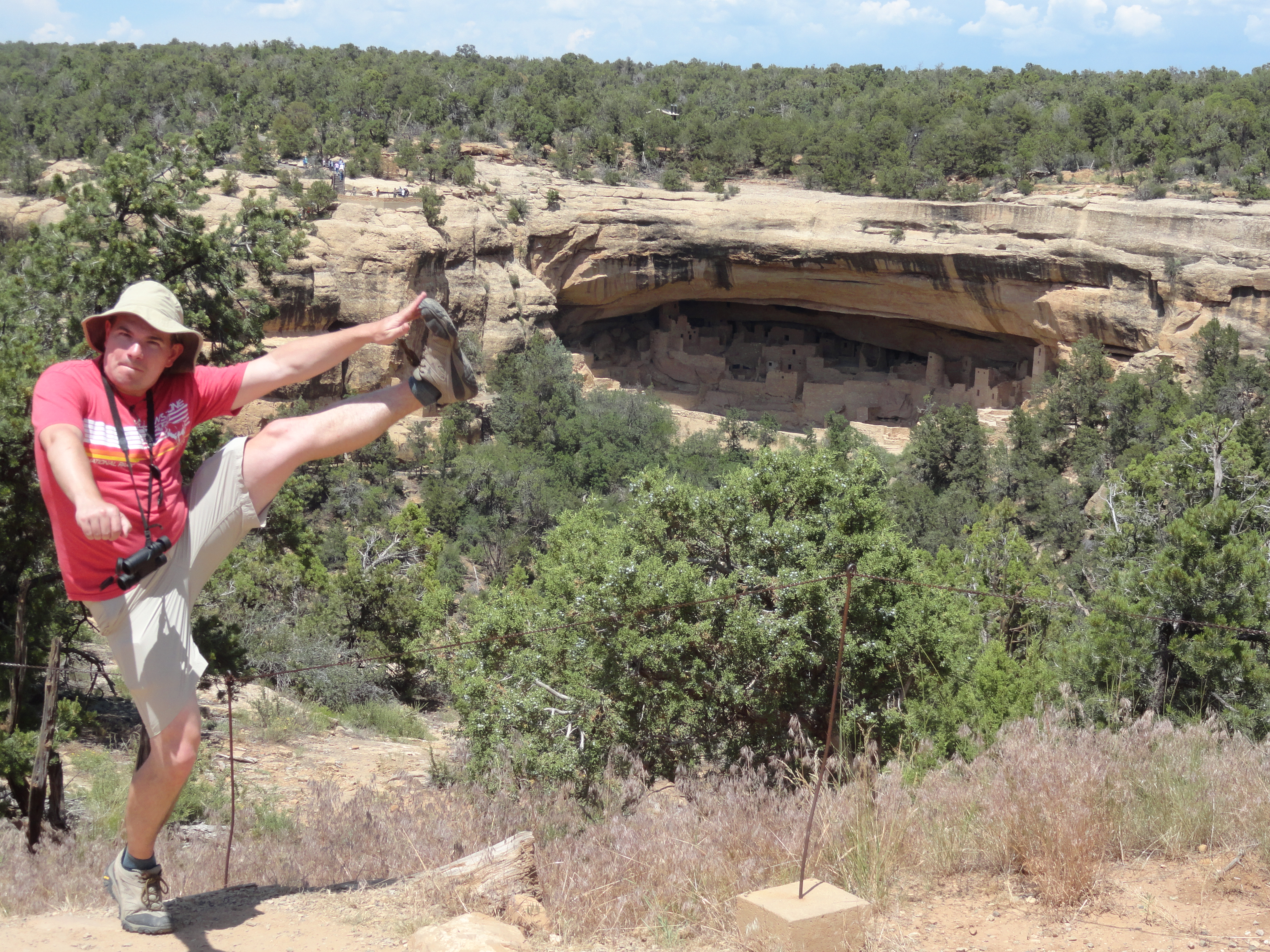
After a quick cruise through open range atop Cedar Mesa (complete with cows crossing), we arrived at Natural Bridges National Monument. Utah’s first national monument, created in 1908, contains three examples of water-carved natural bridges, each in a different phase of its life cycle (youth, maturity, and old age). Sipapu Bridge is the largest and best-known in the park and it’s the first encountered on the circular scenic drive. We made the 1.2-mile round trip hike that descends from the White Canyon rim 500 vertical feet down to the dry creek bed. From below the arch towers 200 feet above and provides great photography opportunities. It’s a fairly strenuous hike back out of the canyon, mostly because of the heat that was already cranking up in the morning sun. At Kachina and Owachomo bridges we only stopped at the overlooks. With a thickness of only 9 feet at its center, Owachomo represents the old age phase of bridge making. Eventually with enough erosion bridges like this will collapse under their own weight.

SipapuBridgeBelow

Nick is dwarfed by the 200 foot Sipapu Arch.

The easiest way to get to the town of Torrey, Utah from Natural Bridges is to head north on Utah 95 and then west on Utah 24, but we had a more compelling plan. Veering west on Utah 276 leads to Hall’s Crossing in Glen Canyon National Recreation Area. It’s the location of a historic river crossing, and after the filling of Lake Powell, became the southern landing point for the car and passenger ferry to Bullfrog, on the opposite shore. The boat Charles Hall makes four daily round trips, but it’s important to call or email ahead of time to ensure the boat is running. Having to backtrack would have cost us hours, so we made sure to confirm the schedule and then arrived at the loading point with a half hour to spare before the Noon departure. The half hour ride was a nice break in the driving and we took a lunch break at the Anasazi Restaurant in the Defiance House Lodge in Bullfrog before continuing.

BurrTrailWaterpocket

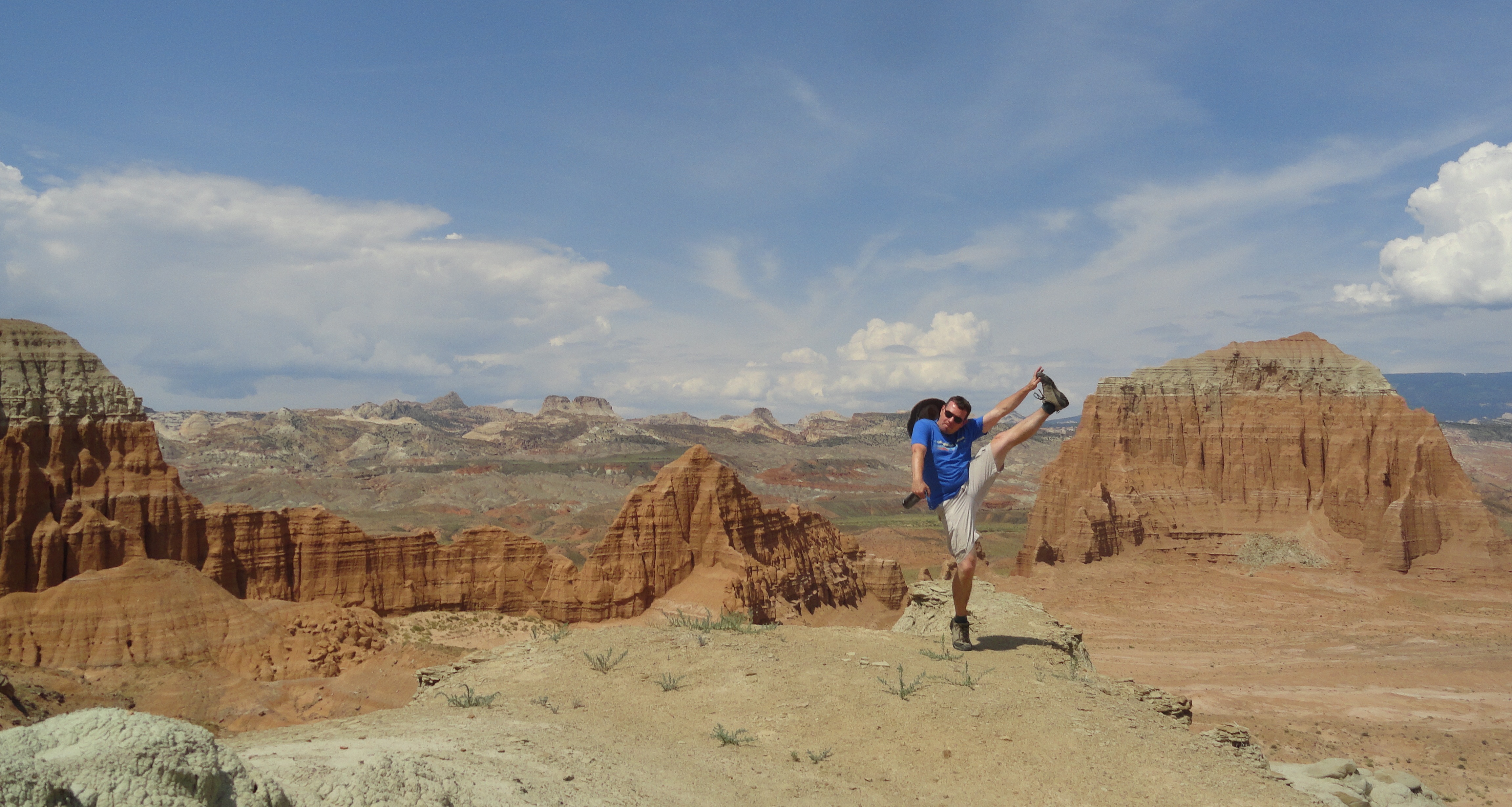
Nearing the Waterpocket Fold along Burr Trail.

Our next detour leg was to enter the remote southern stretches of Capitol Reef National Park via the Burr Trail. We stopped by the Bullfrog visitor center to ask a ranger about current road conditions and were given a report of “bone dry”. The Burr Trail is a mostly unpaved 68-mile route that can become tricky or impassable after a rain. It follows an old cattle trail used to take livestock from summer to winter grazing grounds. Along its southern section, the craggy, upturned ridge of rock known as the Waterpocket Fold came into view on the left. It’s the main geologic feature that defines Capitol Reef and is an incredible sight to see from any angle. We chose this southern entrance approach because otherwise it’s a long round trip from Torrey that we wouldn’t have had time to make. A few miles after passing the park boundary sign, a left turn leads to a narrow gap in the rock and a set of steep switchbacks that crawl over the waterpocket fold. It’s about 1,000 feet up and pretty rough, but the Mazda 3 handled it like a champ. Beyond the summit, we rejoined a paved road that wiggled its way through forest, then a steep-walled red canyon and then amongst giant lumpy mountains of white rock before emerging at the town of Boulder, Utah. From here, Bryce Canyon National Park (which we visited in 2012 and highly recommend) is just 75 miles to the west and Torrey is about 40 scenic miles to the north along Utah 12, traversing Boulder Mountain and overlooking Capitol Reef the whole way. After a quick visit to the park visitor center to orient ourselves and pick up brochures, we settled in at our day’s destination, Rim Rock Inn, and enjoyed a giant pizza and pitchers of beer at their Patio restaurant. What a day.

Up Next: Capitol Reef

RimRockPatio

Nothing hits the spot like pizza and beer after a long day of traveling.

Posted in Destinations, En Route, Travel Tips | Tagged , , , , , , | 4 Comments

Western Parks Part 2: Great Sand Dunes to Mesa Verde

MesaVerde

Continued from Part 1

The following day was our travel day between Great Sand Dunes and Mesa Verde. It’s only about a four hour drive, so there was no need to rush. Along Highway 160 we crossed the Continental Divide at Wolf Creek Pass, elevation 10,857 feet, and then rapidly descended 5,000 feet into southwestern Colorado. There is a notable National Monument along the route, Chimney Rock, which just became a monument in 2012, but the tour length and schedule didn’t work well with our timing, so we just satisfied ourselves with the view from the highway. Lunch time coincided nicely with our arrival in the quaint mountain town of Durango. We’d looked up some restaurant options ahead of time and naturally decided on Steamworks Brewing. Durango’s Main Street is a nice place for a walk, and it would surely provide lots of activities for a longer visit, including the famous Durango and Silverton scenic railway, if you have the time.

MesaVerdeVisitorCenter

Mesa Verde visitor center with Point Lookout in the background.

Continuing on, it’s just another 40 minutes to the Mesa Verde visitor center, and as soon as you pass the town of Mancos, the parks comes into view. We weren’t expecting such a dramatic landscape, but the park occupies a mesa (or more accurately a cuesta) that towers 2,000 feet above the valley to its north, making for a grand approach. The main visitor center is located just off the highway, this is where tickets can be purchased for the dwelling tours that require a park ranger guide. We had purchased a twilight tour of Cliff Palace online ahead of time and upon arrival here added tours of Balcony House and Long House (which can only be bought in person). Keep in mind that of the large dwellings, only Spruce Tree House and Step House are self-guided.

Our Cliff Palace tour was scheduled for 7:00PM in the southern reaches of the park, so we had a few hours to make our way there. The steep Mesa Top Ruins Road begins its climb up the edge of the escarpment just beyond the visitor center. At the turn for the campgrounds we took a right to get to the trailhead of the Point Lookout Trail that leads to the high point of land we could see approaching the park. It’s a 2.2 mile round trip with the half mile closest to the parking area being very steep with a ton of switchbacks. After that it levels out along the top of a thin ridge and emerges from the vegetation onto a bare rock ledge at the tip. A sheer cliff drops hundreds of feet on all sides before reaching a steep slope to the valley floor below. From Point Lookout, views stretch over the Montezuma and Mancos Valleys to the La Plata Mountains to the north and the distinctive Sleeping Ute mountain to the west. Being mostly known for Ancestral Puebloan archaeology, Mesa Verde doesn’t advertise itself as a hiking destination, so this trail was a nice surprise. Next we stopped by Park Point, which is the highest elevation in the park but is not as dramatic as Point Lookout. Here, a very short trail leads from a parking area to a fire lookout at the peak. There’s a 360 degree view and interpretive signs to tell what distant landmarks can be seen. A few miles beyond Park Point lies the Far View Area, a cluster of visitor buildings including a cafe, gift shop, restaurant and our lodging for two nights, the Far View Lodge. This is the only non-camping lodging located within the park and we highly recommend staying here for convenience. Visitors who stay outside the park in nearby towns have a long drive in and out of the park each day, Far View is 15 miles from the park entrance and just 6 miles from the major cliff dwellings. Our room contained the all-important refrigerator and coffee maker and featured a balcony with a sweeping view toward the south, we could even see Shiprock 45 miles away in New Mexico. After getting settled in, it was time to drive to Cliff Palace for our 7:00 Twilight Tour. Ranger Marie Clark met our group of 15 at the overview point and led us down steep, rocky stairs to the dwelling below. Approaching Cliff Palace in person for the first time goes up there with the first view of Crater Lake or seeing Denali on a clear day on the National Park “Awestruck” meter. Photos just don’t do it justice.

MarieClark

Ranger Marie playing the part of Jean Pinkley.

As part of the twilight tour experience, each guide plays a character to help bring the stories to life. Ranger Marie assumed the identity of real 1950s-60s Mesa Verde archaeologist Jean Pinkley for most of the tour. We learned about the ways of life of the Ancestral Puebloan and the discoveries of the cliff dwellings through the eyes of Jean. After touring the site and seeing ceremonial kivas and an ancient painting, we left the site by climbing up narrow ladders between boulders, giving us an extra appreciation for the skill it took to live in cliff dwellings.

ExitingBalconyHouse

Exiting Balcony House.

The following day was a full day in the park and we planned to cover a lot. We started with a tour of Balcony House led by Ranger Drew. Balcony is the most adventurous tour because entering it requires climbing up a 30 foot ladder and exiting involves crawling through an 18 inch wide tunnel, followed by three ladders up a rock face. One of the most memorable things about this house, aside from the view, is a handprint “painted” in the rock by a resident. It’s one of those little surprises that reminds you that “woah, this stuff is 800 years old.” Next we headed to the nearby Chapin Mesa area to see the artifacts in the Archeological Museum, it’s a nice collection and worth a walk through. Just outside the museum are some of the other major hiking trails at Mesa Verde. A short trip below is Spruce Tree House, the most restored of the park’s dwellings. A turn before Spruce Tree House takes hikers on the 2.4 mile round trip Petroglyph Point Trail to the largest collection of petroglyphs in the park. The trail is relatively level once you make the initial descent, but has some ups and downs as it hugs the edge of the cliff above Spruce Tree Canyon. Around the halfway point, the 30-foot wide panel of petroglyphs appears above the trail to the left. The guidebook available at the trailhead has an interpretive diagram to explain the symbolism. Immediately after leaving the petroglyphs, the trail makes a brief but steep climb and then follows the canyon rim all the way back to the Chapin Mesa area. Keep in mind that the first half of the hike is mostly in shade, but the second half is completely exposed to the sun, so take lots of water and sunscreen. We then completed the Mesa Top Loop road, stopping along the way to see the pit houses, Square Tower House and a distant view of Cliff Palace.

Long House at Wetherill Mesa, the second-largest dwelling in the park.

Long House at Wetherill Mesa, the second-largest dwelling in the park.

We had a 5:00 guided tour of Long House scheduled, which is a 30-40 minute drive from Chapin Mesa, so we freshened up a bit at our room at Far View and then drove the curvy road to the remote section of Mesa Verde known as Wetherill Mesa. This area is far less visited, which is nice, but there is only a small ranger station and snack shop for services. We met our ranger guide under the tent and hiked down the Long House Loop paved trail to the entrance to Long House. There used to be a shuttle that drove this loop, but currently it has to be walked or biked. Bringing a bike would be great for this area, but the only bike rentals currently available are outside of the park, too far to easily make a single-day rental. A steep, but fairly easy hike leads from the paved trail to Long House, the second-largest cliff dwelling in the park that was once home to as many as 150 people.

Mesa Verde is more developed and has many more food options than Great Sand Dunes. Both nights we stayed at Far View, we dined at the Metate Room, a full-service restaurant featuring Southwestern inspired food made with local ingredients. Elk Shepherds Pie is their specialty and they have some interesting Colorado wines on the list as well. The La Mano Lounge upstairs offers appetizers, drinks and a large rooftop patio perfect for enjoying a beer under the stars while watching distant thunderstorms. The nearby Far View Terrace restaurant is a good option for more casual dining with cafeteria-style service, we enjoyed breakfast there. A perfect lunch spot was the Spruce Tree Terrace Cafe adjacent to the Chapin Mesa Archeological Museum. Lunch and dinner is served there and you can take a picnic to-go to eat in the park. Their specialty is the Navajo Taco, which was enormous and hit the spot after a morning of exploring and hiking.

Overall, Mesa Verde proved to be one of those great “total package” National Parks, with history, culture, scenery, hiking, lodging and dining all well-represented. Put this one on your must-visit list.

Up Next: The route between Mesa Verde and Capitol Reef

Posted in Destinations, Maps, Travel Resources | 5 Comments

Western Parks Part 1: Iowa City to Great Sand Dunes

ChicagoToSandDunes

We knew going in that it was going to be the longest road trip we’d ever taken. We had looked at options like flying to Denver or Salt Lake City, but decided on an all-car route in the end. Since our first national park was a 20-hour, 1,200-mile drive away, we looked for ways to break up the westward drive into manageable sections. It’s basically two full days to get to Great Sand Dunes National Park in south-central Colorado, so we made plans to stop overnight with our road trip friends Emily and Jake in Iowa City. While in the area, we were introduced to a favorite local hangout, Baxa’s Tavern and Sutliff Bridge. Baxa’s is a classic small town tavern on the banks of the Cedar River about a half hour from Iowa City. A bridge listed on the National Register of Historic Places crosses the river just across the street and is outfitted with picnic tables so you can take your beer and enjoy it over the river. It’s an especially popular destination with cyclists. In Iowa City we had a great dinner at Pullman and quality cocktails at Clinton Street Social Club.

Inside Nebraska's Great Platte River Road Archway Museum.

Displays of Oregon Trail hardships inside Nebraska’s Great Platte River Road Archway.

Our head start from Chicago to Iowa City allowed us to take our full day of driving at a slightly more leisurely pace. The route across the Great Plains of Nebraska and Colorado can be a tedious one, but breaking it up with some stops can do wonders for making it feel shorter.  We’ve passed under the Great Platte River Archway Monument several times and always were intrigued by it, so we finally planned to visit. Anyone who has traveled this stretch of I-80 knows the sight of the giant bridge-like structure stretching across the freeway near Kearney. It holds a historical museum focused on the pioneer trails that brought settlers into the United States’ western territories. The Oregon, Mormon and California trails all converged here at Fort Kearney before proceeding along the Platte River as one. The Archway museum begins with pioneer times and progresses through history from wagon trains to railroads to highways to fiber optic cable lines, all of which first followed this same route across Nebraska. An audioguide narrates as you walk through the exhibits inside, and an outdoor section has some walking trails and re-creations of early prairie housing. Back on the road, we skipped the Interstate and veered south on 2-lane roads into surprisingly beautiful northwestern Kansas toward our pre-planned stopover town of Colby. We selected Colby because of its approximate 8-hour drive time from Iowa City, and because it has a decent selection of hotels due to it being along Interstate 70. The next morning we visited Monument Rocks, the country’s first National Natural Landmark. It’s a cluster of 70 foot tall white cliffs eroded from the otherwise rolling, green landscape. It’s not a site to make a special trip to visit (there are no visitor facilities), so you just find yourself out in the silence of the prairie looking at a rock, but it’s worth a stop if you happen to be passing by, like we were. It was another six hours to get to Great Sand Dunes National park from Monument Rocks. Highway 160 took us across the flat, dry plains of eastern Colorado with the Rockies peeking up over the horizon as a backdrop. Past Walsenberg the road finally climbs into the Sangre de Cristo Mountains and then over the La Veta Pass into the San Luis Valley, where the first park of our trip lies.

DunesSunset

Sunset from Great Sand Dunes Lodge, wishing we had some good beer.

Great Sand Dunes National Park protects in immense field of sand deposited by thousands of years of erosion from the surrounding mountains. Parts of it have been blown and piled up against the base of the Sange de Cristo range, creating the tallest dunes in North America, up to 750 feet deep. In this unique location, shifting winds and bordering streams have created a delicate balance, resulting in a remarkably stable dune field. Our entrance to the park was marked by an impressive afternoon lightning storm (that would prove to be a common theme throughout the trip). We checked into the Great Sand Dunes Lodge, the nearest lodging to the park, located right at the park border. It offers everything you need for your stay in one location: hotel rooms, camping sites, cabins, restaurant, gas station and convenience store. The rooms are large and comfortable and they all have a back patio overlooking the dune field and mountains beyond, perfect for sunset viewing with a beer. Speaking of beer, there’s one piece of information we wish we’d thought of ahead of time. Colorado only allows the sale of beer above 3.2% at state licensed liquor stores, meaning if you buy beer in a convenience or grocery store, all you’ll get is a small selection of the watered down stuff. The nearest liquor store is 20 miles from the park, so we made do with some 3.2 Dos Equis. A shame in a state known for craft brewing.

Hiking amongst the dunes.

Losing ourselves amongst the dunes.

On our full day in the park, we rented sand boards from the lodge and headed off. A parking lot near the visitor center provides easy access to the dunes. Take your shoes off and wade through the shallow Medano Creek to get to the base, then climb up wherever you feel like it. The best method is to select a sand ridge and walk along it toward the top, popular paths are pretty obvious even without markers. Most visitors who hike the dunes aim for High Dune about 2 miles away. It’s a 700 foot high pile of sand that gives 360 degree views of the park. A few visitors continue on toward Star Dune, but most make their way back down. How you descend is entirely up to you. We had carried our sand boards all the way up, so we decided to try them out. We found a nice smallish slope and strapped in. First impression: sandboarding is nothing like snowboarding. The learning curve for sandboarding is pretty steep and sand is not nearly as soft to land on as it would seem. We both had some spectacular wipeouts and for a while we thought Nick wasn’t going to be able to sit for the rest of the trip. While it was a blast, our recommendation is to also consider sand sledding. If we’d rented one sled and one board, we probably would have gotten more enjoyment out of the rental.

While the dunes are by far the most popular portion of the park, there are many other areas to explore, including streams and mountain habitats. We hiked the Dune Overlook Trail by way of the Sand Ramp Trail, it’s a short climb, but offers a great viewpoint at the end. We considered the Mosca Pass Trail that climbs through an alpine valley landscape along Mosca Creek, but decided to stick closer to the dunes since we’d get our share of alpine scenery in the near future. One park down and seven to go!

Up Next: Mesa Verde National Park


Posted in Destinations, Travel Resources | Tagged , , , , , , , , | 5 Comments

National Park Kick: Arches/Canyonlands

Delicate Arch, Arches National Park/Grand View Point, Canyonlands National Park - July 2015

Delicate Arch, Arches National Park/Grand View Point, Canyonlands National Park – July 2015

Known for their spectacular rock formations, Arches and Canyonlands National Parks are easily accessible from hwy 191 just north of Moab, UT. Use Moab as your base and schedule at least a full day in each park to get a feel for the geological wonders of both.

Arches
-See: Delicate Arch at sunrise. While many people hike the moderate 3-mile hike to Delicate Arch at sunset, our decision to go early in the morning was well worth it: no crowds, cooler temperatures, and the unique experience of hiking in the dark!
-Hike: Devil’s Garden trail. This moderate trail features seven major arches. Landscape Arch – one of the world’s longest at 308 ft – is not to be missed.
-Hike: Fiery Furnace. This extremely popular 3-hr ranger-led hike takes you through the incredible maze of stone fins that make up this area of the park. Reservations are required and can be made online anytime (AM hike) or in-person up to 2 days in advance (PM hike).

Canyonlands (Island in the Sky section only)
-Hike: Upheaval Dome – this mile-wide crater is a mystery even for geologists. Was it created by a meteorite or a salt dome? A moderate hike (2-mi rt) leads you to two overlooks so you can judge for yourself. The Syncline Loop (strenuous 11 mi) leads you into the crater but is not recommended in the Utah summer heat.
-Hike: Grand View Point. Easy 2 miles starting from Grand View Point overlook. Hikers are rewarded with outstanding views of the park along the entire route.
-See: La Sal Mountains through Mesa Arch. This popular viewpoint is a short distance from the scenic drive.
-Note: A small complaint some visitors have about their visit to the Island in the Sky section of Canyonlands is that you can’t actually see the Colorado River from the national park. Dead Horse Point State Park, adjacent to Canyonlands, offers spectacular vistas of the area, including the Colorado River. A short visit to this park is well worth it.
-Note: If you have a second day to spend in Canyonlands, explore the Needles section. Due to its remote location (75 mi south of Moab) it’s like visiting a separate park.

Moab
-Stay: Inca Inn. Conveniently located on hwy 191 as you enter Moab, this hotel turned out to be one of our favorites on our trip out West.
-Eat/Drink: After a long day of hiking, enjoy a great meal and cocktails at Jeffrey’s Steakhouse. Reservations are strongly recommended.
-Eat/Drink: Moab Brewery. Standard pub fare and local brews.
-Eat: There are no food services in either Arches or Canyonlands. Visitors should plan on taking a picnic lunch (Love Muffin Cafe opens early and makes food to-go) or returning to Moab to eat (both Peace Tree Juice Cafe and Eklecticafe offer light meals in a relaxed atmosphere).

Dead Horse Point State Park, UT

Colorado River from Dead Horse Point State Park, UT

Posted in High Kick Photos | Tagged , , , , , , , , , | 1 Comment

Statistics: Western Parks Road Trip

Click for larger version.

Posted in Maps | Tagged , , , , , , , | 1 Comment

Western Parks Road Trip Gallery

Images from our 4,572 mile Western road trip, June 26 through July 16, 2015.
Click to enlarge, read captions and view slideshow.

Posted in Destinations, High Kick Photos | Tagged , , , , , , , , , , , , , , , , , , , , | Leave a comment

National Park Kick: Capitol Reef

Lower South Desert Overlook, Capitol Reef National Park, UT - July 2015

Lower South Desert Overlook, Capitol Reef National Park, UT – July 2015

Capitol Reef National Park is located in south-central Utah. Its main feature is the 100-mile long Waterpocket Fold – a giant wrinkle on the earth. The scenic park drive only offers a glimpse of the geological features found in the area. Further exploration by foot or 4-wheel drive is a must!

-Stay: Located in the nearby town of Torrey, UT, the Rim Rock Inn offers convenient accommodations for a reasonable rate. The hotel has 2 good restaurants on site and is close to the park entrance.
-Hike: The Capitol Gorge trail (2 mi. rt, easy) follows a wash that cuts through the Waterpocket Fold, with canyon views, petroglyphs and pioneer inscriptions. A moderate spur trail to a series of water pockets is also worth it.
-Drive: The 59-mile Cathedral Valley Loop offers visitors access to the much less travelled northernmost section of the park. If you have the time and a suitable vehicle – it took us 6.5 hrs in our rented Jeep – the views are plentiful and absolutely stunning.
-Drive: The Burr Trail Road offers a unique approach to the park, travelling through its southern section. We drove the entire 68-miles from Bullfrog, UT to Boulder, UT, including an infamous series of switchbacks climbing 800 feet in half a mile! Even though some sections are paved, check with a ranger beforehand to make sure the road through the park is passable to all vehicles.

Posted in High Kick Photos | Tagged , , , , | Leave a comment

National Park Kick: Mesa Verde

Cliff Palace overlook, Mesa Verde National Park, CO - June 2015

Cliff Palace overlook, Mesa Verde National Park, CO – June 2015

Our second park on this trip was Mesa Verde National Park. When most people think of Mesa Verde, they most likely picture Ancestral Pueblo cliff dwellings. As we discovered, this is only a small aspect of what soon became one of our favorite national parks. The two days we spent in the park allowed for a good balance of hiking and culture.

-Stay: Far View Lodge – only hotel in the park. Since the majority of the park’s cultural sites are at least an hour’s drive from the park entrance, spending your night here will save you a lot of time spent in the car. Also, the views are amazing and the Metate Room has great food.
-Tour: No matter how long your visit, allow time to take a ranger-led cliff dwelling tour. We were able to do the Cliff Palace, Balcony House, and Long House tours, each unique in their own way. We particularly enjoyed the Cliff Palace Twilight tour: it is limited to 20 people (other tours allow up to 50 people) so it doesn’t feel crowded, and the evening sunlight is great for photos. Note: All tours can be booked at the visitor center, except for the Twilight tour which must be booked online.
-Hike: The Point Lookout trail (2.2 mi. rt, moderately strenuous due to the steep beginning) rewards you with a stunning panorama of the Montezuma and Mancos valleys below. The Petroglyph Point trail (2.4 mi. loop) begins near the Chapin Mesa Archeological Museum (a great introduction to the Ancestral Pueblo People), follows the cliffs along Spruce Canyon to a 12 ft. wide petroglyph panel, and returns via the mesa top.
-Drive: A 6-mile loop, the Mesa Top Loop allows you to see a variety of archeological pit houses and kivas as well as an excellent view of Cliff Palace and Navajo Canyon.

Posted in High Kick Photos | Tagged , , , | Leave a comment

National Park Kick: Great Sand Dunes

High Dune, Great Sand Dunes National Park & Preserve, CO - June 2015

High Dune, Great Sand Dunes National Park & Preserve, CO – June 2015

Great Sand Dunes National Park & Preserve was the first stop on our 8-park adventure this summer. Our time here included hiking, trying out some sandboarding, and enjoying the peace and quiet that comes with visiting one of the lesser-known national parks.

Our favorites:
Stay: The Great Sand Dunes Lodge is located right at the entrance of the park, walking distance from the only restaurant in the area. All rooms come with a patio overlooking the dunes – great for enjoying the sunset with a beer.
Do: Hike to the top of High Dune, the highest point on the dune field. At almost 700ft tall, it makes for quite a climb. Once you wade through Medano Creek, there are no marked trails so you are free to make your own itinerary to the top (our hike ended up being 4 miles round-trip). Make sure to go early in the morning before the sand gets too hot or afternoon thunderstorms develop.
Do: Go sandboarding or sandsledding in the dune field. We rented our boards for the day from the Great Sand Dunes Oasis. It’s definitely more challenging than it looks!
Do: Hike the Dunes Overlook trail (moderate – 2 miles r/t) to get a good perspective of the dune field, Medano Creek, and the San Luis Valley.

Posted in High Kick Photos | Tagged , , , , | Leave a comment

Summer 2015: National Parks

A brief overview of the 8 parks we’ll be visiting in the next few weeks:
Click for larger view.

Posted in Destinations, Maps, Upcoming Travel | Tagged , , , , , , , , , , | Leave a comment