Our spring break 2017 trip took us back to the desert southwest. Here’s some statistical info on how it all went down. Click the image for larger view.
-
-
Latest Posts
Search for a destination
Our spring break 2017 trip took us back to the desert southwest. Here’s some statistical info on how it all went down. Click the image for larger view.
Images from our trip through Arizona and California, April 6-16, 2017.
Click to enlarge, read captions and view slideshow.
A few fun facts and some infographics (scroll down) aboutOur Lodging: Lodge on the Desert – Tucson, AZ
Our Lodging: Wigwam Motel – Holbrook, AZ
Our Lodging: Thunderbird Lodge – Chinle, AZ
Our Lodging: Maswick Lodge – Grand Canyon Village, AZ
Our Lodging: Stovepipe Wells Hotel – Death Valley, CA

We’ve been lining up our next road trip for several months, but now that it’s less than two months away we can reveal the planned route. It’s a return to the American Southwest this April, highlighting Arizona and California. Travel partners Emily and Jake are also joining us for the first time since Alaska 2014! There will be three new national parks added to our tally: Saguaro, Petrified Forest and Death Valley, plus a revisit to Grand Canyon, and at least four National Monuments.
The week begins by flying into Tucson, Arizona, where we’ll spend time at Saguaro National Park. Next up is a day exploring Petrified Forest National Park before continuing to far northeastern Arizona and Canyon de Chelly National Monument. Turning west, we’ll take a peek at Meteor Crater on the way to spending two nights in and around the city of Flagstaff. Several National Monuments dot the landscape around Flagstaff, so finding activities won’t be a problem. We can’t go this close to the Grand Canyon without stopping by, so we’ll make a quick return visit to try out a trail we didn’t hike on our 2012 excursion. Following Grand Canyon, we’ll enter California for the first time in five years and stay 2.5 days in Death Valley National Park. The flights home will be out of Las Vegas.
After this route, we will have just 13 more national parks to visit, only five of which are in the continental U.S. Don’t worry, we’ll still manage to find plenty of destinations, our in-progress summer plans are shaping up and we’ll be helping celebrate the 150th anniversary of our northern neighbors come July and August. More on that to come.
2016 was another busy year of exploring. From the lonely landscapes of western Texas and New Mexico in April, to the watery world of the upper Great Lakes in July, we observed wildly contrasting parts of the continent. Internationally, we had a memorable rowboat border-crossing into Mexico and made an arc through the surprisingly rugged scenery along Canada’s Lake Superior shore. We even threw in a long weekend in Door County, Wisconsin as a quick fall getaway. Plans are currently underway for 2017 travel, and it’s looking to be another active year!
See photos and travelogues from our spring break trip to Texas and New Mexico.
See photos and travelogues from our Great Lakes trip.
As always, click the image below for a larger view.
The final leg of our summer road trip took us through both the upper and lower peninsulas of Michigan. We’ve previously traveled to Detroit, Grand Rapids and the southwestern shore, but this was our most extensive visit to the Great Lakes State. Here’s the breakdown on what we saw, and why you should visit beautiful Michigan, in order of appearance from north to south.
Tahquamenon Falls:
After reentering the United States at Sault Ste. Marie, our first stop was Tahquamenon Falls State Park. This is where the Tahquamenon River plunges over two sets of waterfalls, the upper is a 200ft wide, 48ft high single drop, while the lower set is a collection of five smaller cascades. We headed to the larger upper falls, which is the third most voluminous waterfall in the eastern U.S. during the spring runoff (after Niagara and Cohoes Falls.) A short trail leads from the parking area to the river, with two sets of stairs leading guests down to dramatic viewpoints, one right at the brink and one a little farther downstream. Tannins leached from cedar forests stain the water brown, giving it a unique appearance. Conveniently, Tahquamenon Falls Brewery & Pub is located on the premises, so the park stop doubled as our lunch stop. When dining in the Upper Peninsula, don’t forget to have the local specialty, Pasty.
Pictured Rocks National Lakeshore:
Continuing the thread of gorgeous Lake Superior shorelines is the 42-mile stretch known as Pictured Rocks. Sandstone cliffs up to 200 feet tall tower over the lake. Minerals embedded in the porous stone create colorful streaks where groundwater leaches from the cliff face. Iron stains red and orange, copper creates green and blue, manganese oozes black and lime turns white. We began our visit at the park’s eastern edge near Grand Marais, viewing the lake and Au Sable Lighthouse from the Log Slide Overlook. We then drove the full length of the park through thick forests to the town of Munising, headquarters of the park and departure point for cruises. A cruise is the best way to truly capture the views of the namesake cliffs, but there are also hiking, camping and boating opportunities in the park. We chose the 3-hour Sunset Cruise with
Pictured Rocks Cruises, departing the Munising dock at 7:00 pm. The trip was wonderful, but one thing to keep in mind is that Munising does not have many options for late evening dining, so plan to eat ahead of time or order a giant pizza from Main Street Pizza afterwards like we did. Our lodging was at the Terrace Motel, which had friendly service, a lounge in which to eat the aforementioned pizza and one of the best bedspreads of all time (see at left).
Mackinac Island:
We usually allow ourselves one tourist trap per trip, and this fit the bill. Interestingly, the historic island in Lake Huron was designated the second National Park after Yellowstone, but in 1895 it was decommissioned and returned to the control of Michigan, which now operates part of the island as a state park. Each day, thousands of tourists pile into ferry boats that shuttle them to the village on the island’s southern shore. Upon disembarking, they’re immediately herded onto a Main Street lined with restaurants, ice cream & fudge parlors, cheap t-shirt stores and bike rental shops. Crowds of people mill around the sidewalks while bikes and horse drawn carriages clog the street. The whole island is car-free, which is its most unique quality. We found a good lunch at Millie’s on Main and then rented bikes to escape the circus. An 8-mile loop trail circumnavigates the island and allows somewhat of an escape from the chaos. We also rode our bikes to Fort Holmes (on the island’s highest point) and Arch Rock before eating some ice cream and ferrying back to the mainland. There are some lovely views, but it wasn’t enough to move Mackinac Island out of our tourist trap column. After leaving the dock at St. Ignace, we continued south by car to the lower peninsula by crossing the spectacular 5-mile long Mackinac Bridge, an attraction in its own right if you’re into nerdy things like that (we are).
Wilderness State Park:
Now that we camp (see Isle Royale) we’ve opened up a whole new set of overnight opportunities. The northern tip of Michigan’s lower peninsula is full of hotels, inns and B&Bs, but with them all charging peak-season rates, and knowing we’d have our tent in the trunk, we expanded the search to include campgrounds. We found exactly what we were looking for at Wilderness State Park, just 11 miles from Mackinaw City. Their newly created “tent-only rustic campground” contains 10 sites along the Lake Michigan shore that can be reserved for only $20 per night. To be honest, being located right next to the park road and the full hookup RV sites full of families made it less rustic than we were expecting. Each of the 10 sites has a parking space so you can drive right up, but they are pretty well separated by trees, so it’s possible to pretend you’re actually in the wilderness. There is an outhouse and running water in the area, which further eases the experience. Two general stores nearby meant food options were much more luxurious than our dehydrated meals at Isle Royale. We built a raging campfire and dined on cheddar brats, green beans and beer while lounging in our camping chairs. Wilderness State Park is also adjacent to Headlands International Dark Sky Park, which allowed us to watch the Milky Way glow into view after a stunning sunset.
Traverse City:
We spent two nights in northern Michigan’s largest town. Traverse City‘s well-known food and beverage scene is what initially attracted us and we took full advantage. With so much of this trip taking place in low population areas, having multiple gourmet options was a welcome turn of events. We tasted our way across town with stops at North Peak Brewing, Filling Station Microbrewery and Traverse City Whiskey Company. The cocktail bar scene is happening too, with Low Bar and The Parlor being our favorites. There’s more to do that boozing here, with beaches for lounging and shops for browsing. On the dining side, we indulged in dinners at Bistro Foufou and Trattoria Stella, both being excellent choices. Traverse City officially erased any fitness gains we achieved during the active portions of the trip. Oh well.
Old Mission Peninsula Wine Country:
This skinny 18-mile strip of land poking into Grand Traverse Bay provides an ideal microclimate for growing wine grapes. Ten wineries line the central road providing the perfect opportunity for a wine crawl. We started the day at the peninsula’s northern tip by visiting the Mission Point Lighthouse, then made our way south via three wineries. We kicked things off at Two Lads, where we loved both the wine and the super modern tasting room overlooking the bay. This proved to be our favorite of the bunch, and the helpful server helped us decide where to drink next. Our other two wine stops were the charming Bowers Harbor and the massive Chateau Chantal. For lunch, Bad Dog Deli offers delicious homemade sandwiches. The laid back vibe and quality wines made for a perfect “Pure Michigan” kind of day.
Sleeping Bear Dunes National Lakeshore:
Just a half hour from Traverse City lies what has been called the most beautiful place in the country. Sleeping Bear Dunes National Lakeshore protects 35 miles of eastern Lake Michigan shore plus North and South Manitou islands. A lighthouse, life saving stations, farmsteads and coastal villages are also within the Lakeshore, providing a good balance of natural and cultural amenities. Sand hills towering up to 450 feet above the lake line the shore, giving views far out over the blue and green water. The Dune Climb is a popular activity that we did not partake in because of the 90 degree weather during our visit. The Sleeping Bear Point Coast Guard Station contains an informative maritime museum of the Great Lakes shipping industry and shipwrecks in the region. Stop for lunch at the famous Art’s Tavern in the Village of Glen Arbor.
Ludington:
Northern Michigan is full of charming small towns frequented by summer guests. Some of the more popular ones can feel a bit too touristy and artificial (see Mackinac Island), but Ludington is a town that successfully blends it’s visitor friendliness with the feel of a real working place. Highlights for us included coffee at Redolencia, mac and cheese dinner at Barley & Rye, and a live rockabilly band at The Mitten Bar (which was called one of the best beer bars in the country by Food & Wine.) Summer’s Inn was one of our favorite hotel stays of the whole year, with its wine tastings, backyard garden, guest library and wonderful breakfast. If crossing Lake Michigan by ferry sounds interesting, Ludington is also the eastern port of the SS Badger, with twice daily service to Manitowoc, Wisconsin during the summer season.
Journeyman Distillery:
We never pass up a good brewery or distillery on our route, so when we discovered that Journeyman was just off I-94 in Three Oaks, Michigan, our lunch break planned itself. The new restaurant, Staymaker, is in part of the same former corset factory (stays, get it?) as the distillery. It offers cocktails made with Journeyman products and a full menu of lunch and dinner options. We each selected a Detroit-style pizza and a cocktail to toast to our last meal on the road. In less than two hours, we’d be back home in Chicago after nearly three weeks and over 2,400 miles on the road.
Previously: Canada
Previously: Isle Royale National Park
Previously: Apostle Islands, Voyageurs and Grand Portage
View the whole gallery of images from our trip here.

Welcome to Ontario, that pesky Nipigon River Bridge, Hattie Cove at Pukaskwa, park entrance and White River Suspension Bridge.
Upon rejoining society after four days on Isle Royale, it was time to push even farther north. Just a 15 minute drive from the dock we pulled into Grand Portage State Park, right along the Pigeon River that separates the United States and Canada. The highlight of the
park is the 120-foot tall High Falls, one of the major obstacles the voyageurs were avoiding on the Grand Portage Trail. A half-mile paved trail and boardwalk leads to two viewpoints of the tumbling falls and the Canadian side of the canyon. Back in the car, we crossed the Pigeon River and got our passports ready for the customs agent. He gave us the standard questions about where we were going and how long we’d be in the country, and we were welcomed with typical Canadian friendliness. The only real adjustment we had to make was squinting at the teeny kilometer numbers on our American speedometer. Seriously, why can’t the U.S. just join the modern world and use the Metric system already?
The Canadian portion of the journey was planned as a series of brief stops rather than multi-day stays like at Voyageurs and Isle Royale. In retrospect, part of that was due to the difficulty of finding online tourism information about this remote portion of Ontario. We knew of a few spots we wanted to hit ahead of time, but after passing through, we found
there are more worthwhile destinations than we realized. The region’s beauty surprised us at every turn and the places we planned to see exceeded our expectations. The north shore of Lake Superior is really an undiscovered and underrated corner of the world. Our pleasant experience was enhanced by the days of consistently perfect weather. Arriving at the peak of the summer season, temperatures were comfortably in the upper 70s and low 80s (F) and skies were nearly cloudless. Locals assured us this is rare, since Lake Superior is so large it creates its own weather systems and can stir up a storm at a moment’s notice.
That being said, our first night’s stop was in Thunder Bay, Ontario. From Isle Royale we’d been looking across the lake at the bay’s entrance, so it was cool to be on the other side seeing the island as a sliver on the horizon. Thunder Bay has an interesting recent history, having been formed in a merger of the twin cities of Port Arthur and Fort William in 1970. There remain two distinct “downtown” districts, but it now operates as one municipality. City population is around 110,000, making it the largest in Northwestern Ontario, but only 19th in the province as a whole. (As a reminder of the large size of Canadian provinces compared to our states, Ontario shares a border with most of Minnesota and Upstate New York at the other end, that’s quite a spread) We settled at the Valhalla Inn for the evening, a full-service hotel located near the airport on the edge of town. Since this was about the halfway point of the trip and we’d just spent 4 days on a remote island, it was definitely time to do laundry. Barb’s Laundromat turned up in a Google search and became our base for the next couple hours. There’s no place to hang with the locals and get acquainted with Canadian cash like an old-school laundromat. With everything clean and folded, we decided against venturing out again and dined at the Valhalla’s upscale steakhouse, Runway 25. The restaurant was quiet on the late Thursday evening, but we felt back in our urban element enjoying proper cocktails, wine and steak. Our server Susie was wonderful,
sharing stories of coaching women’s hockey, wolf encounters in her neighborhood and driving her car under a moose. It’s almost like she was planted by the visitor bureau to be the most Canadian person possible for our first evening in the country and we ate it up.
After three nights of sleeping on the ground, a real bed provided a refreshing night’s sleep. The next day we had a long day of driving and sightseeing planned, so we grabbed a quick bite at the Starbucks in Valhalla’s lobby and set out. The first thing we wanted to see was Kakabeka Falls, about 25 kilometers west of Thunder Bay. Here the Kaministiquia River plunges 40 meters over a shale escarpment into a narrow canyon. The site has earned the nickname “Niagara of the North,” since it is only 10 meters shorter than the famous eastern Ontario falls. Kakabeka Falls Provincial Park straddles both sides of the canyon with picnic areas, short walking trails to viewpoints and a visitor center with gift shop. Driving back through Thunder Bay it was approaching lunch time, so we went to the Port Arthur downtown district for lunch at The Foundry. We’d both been lacking in the vegetable department, so ordered salads and beer. Another friendly waiter chatted with us about our road trip and bid us farewell with “Have a good trip, eh.”
We joined the Trans Canada Highway at Thunder Bay and would follow it around Lake Superior for two days. Just outside of town, we pulled off at a roadside monument to Terry Fox, an athlete who set out on a cross-country run to raise money for cancer research in 1980. Unfortunately it was at this point that he had to give up his run, but the memorial plaza and statue overlooking Thunder Bay and Lake Superior speaks to his lasting legacy. From this vantage point there was also a good view of the Sleeping Giant we’d seen on the horizon from Isle Royale. It is part of a large Provincial Park that looks incredible, but will
have to be visited on a return trip. Another hour on the highway led us to our next stopping point, a tiny Provincial Park called Ouimet Canyon (pronounced “we met”). This canyon was a surprising find, as we hadn’t been expecting this part of Ontario to be so rugged. A 150m wide, 100m deep gorge has split open in the volcanic-formed rocks. There are a couple theories on how this happened, but the result is a short but dramatic canyon that is deep enough that plants growing at the bottom are normally found 1,000 kilometers farther north. The park only consists of one pathway that leads to two overlooks, but the views down the sheer walls and out over the lumpy terrain are worth stopping for.
Continuing northeastward took us through heavily forested land to the northernmost reaches of Lake Superior at Nipigon. There’s a fascinating point here, where one bridge literally links the two sides of Canada. It spans the Nipigon River and is the only way to drive across the country without detouring through the United States. In January 2016, an expansion joint on the brand new replacement bridge buckled unexpectedly and completely severed the Trans Canada Highway for a day and caused delays for a month.
Good thing it’s an attractive bridge. We still had two hours of driving to get to our overnight lodging near Marathon at the Pic River Guest Suite. There aren’t a ton of hotel options in this sparsely populated area, so we were happy we booked ahead as always.
Food was equally hard to come by in Marathon on that quiet holiday weekend, resulting in our only fast food experience of the trip at A&W. Luckily the LCBO liquor store was open so we could grab some beers, and a grocery store was available for the next day’s food and supplies. The Pic River Guest Suite turned out to be perfect, located in a First Nations community just a few minutes from the entrance to Pukaskwa National Park. We sat on the back porch swing with our Muskoka beer and watched the sky go dark over the peaceful Pic River.
We awoke to a stunning view of the river steaming beyond the back yard. Even in the middle of summer it gets chilly at night this far north. Pukaskwa National Park (pronounced PUCK-uh-saw) was our main attraction in this region. Parks Canada, the world’s oldest organized national park system contains 38 National Parks and eight National Park Reserves which are intended for future parks. Pukaskwa was established in 1978 and protects the longest undeveloped stretch of shoreline in the Great Lakes. Due to the remote location, fewer than 11,000 visitors arrived in 2015, that’s 8,000 fewer than made the difficult trek to Isle Royale National Park. Services are limited, the only developed area is right inside the entrance where the visitor center, campground and trailheads are located. The 60 kilometer Coastal Trail is popular with backpackers as a
multi-day camping trip and is probably the park’s signature attraction. Being there just for the day, our plan was to hike the first segment of the coastal trail as far as the White River, a trip totaling 16 kilometers. Beginning at the visitor center, the trail heads through the forest alongside Hattie Cove. The start is fairly level, with some sections of trail on planks to protect from mud. A couple kilometers in, the trees open up and the trail crosses a large wetland on a long boardwalk. At the far side of the wetland, the trail re-enters forest and passes through some rocky sections. The last couple kilometers
before the White River pass through a pine forest carpeted in fluorescent green moss. At kilometer 8 the trail crosses the river in spectacular fashion on a 30-meter-long metal suspension bridge hanging 23 meters above a set of rapids. The views are amazing and the swaying bridge is an adventure. We spent a while crossing back and forth looking for the best photo opportunities before settling on the landing to eat our packed lunches. The solitude here rivaled that of Isle Royale. We only passed two hikers on the outbound trip and met a group of four while eating lunch. On the way back, we passed two hikers, one dog and a porcupine who didn’t want anything to do with us and waddled away in a minor panic. After buying a couple souvenirs at the visitor center, we hit the road to complete the Canadian segment of Lake Superior.
The four and a half hours to Sault Ste. Marie provided more unexpectedly beautiful scenery, with countless small lakes nestled in the hills and imposing bluffs plunging down to the Superior shore. A significant portion of the drive was through Lake Superior Provincial Park, another large preserve that would be worth an extended stay on its own. With limited time, we pulled off the highway just once at Agawa Rock to see the famous native petroglyphs. A 0.5 kilometer trail leads to them by way of volcanic rock formations while interpretive signs explain the geologic forces that contributed to the area’s unique appearance. Agawa Rock itself is a 30 meter high granite cliff at the shore. A small ledge at the base allows visitors to view the 150-400 year-old petroglyphs up close as long as the lake is calm. 35 rust-colored images represent historical events and mythical creatures from local Ojibwe culture. Stepping out along the ledge put us face to face with history and left us even more connected to the big lake.
Our final night in Canada was spent in Sault Ste. Marie at the eastern limit of Lake Superior. The St Mary’s River separates it from its identically-named American counterpart in Upper Michigan. The evening consisted of delicious pizza at Solo Trattoria and a restful night at the Quattro Hotel. In the morning we visited the Sault Ste. Marie Canal, a National Historic Site of Canada which contained the largest and first electrically operated lock in the world at its completion in 1895. Looming over the site was the Sault Ste. Marie International Bridge, which would soon carry us back into the U S of A.
Up next: Michigan
Previously: Isle Royale National Park
Previously: Apostle Islands, Voyageurs and Grand Portage
View the whole gallery of images from our trip here.
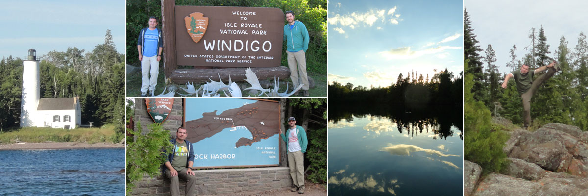
The native Ojibwe people know Isle Royale as Minong, meaning “the good place,” an understatement of the highest order. This, our 43rd national park, is one we’d been dreaming of visiting for a long time. Isle Royale National Park is made up of the largest island in Lake Superior and more than 400 surrounding smaller islands located 20 miles off the arrowhead of Minnesota and 45 miles from Michigan’s Upper Peninsula. Thunder Bay, Ontario and Duluth, Minnesota are the nearest cities. Nearly all visitors arrive to the park by ferry, leaving from Houghton and Copper Harbor, Michigan or Grand Portage, Minnesota. Crossing time is two hours from Minnesota or between three and six hours from Michigan, but getting to a particular part of the island by boat can take much longer. The Voyageur II ferry we took circumnavigates the island over the course of two days, stopping at Windigo and McCargoe Cove before overnighting at Rock Harbor and completing the circle the next day. Backpacking plans revolve around these transportation timetables, but you can get anywhere with some creative scheduling. Isle Royale’s season is short, open from April 16th through October 31st with ferries running from early May through late September. It’s the only national park that completely closes for the winter season, it’s simply too remote and difficult to get to when it’s frozen. The “busy” time is from mid-July through mid-August, but only about 18,000 people visited it in 2015, so you’ll never encounter a crowd.
Once arrived, there are many methods of exploration, a quick day trip (not recommended), a lodge stay with excursions or an an extended wilderness experience. A telling statistic is that the average visitor spends 4 days in Isle Royale, while the average national park visit is just 4 hours. It’s an expansive park, the main island being 45 miles long and 9 miles at its widest, but there are no roads, so the distances are magnified. 99% of the park is designated wilderness, 75% is under water, and other than one lodge and a few cabins, 36 backcountry campgrounds are the only places to stay. All the campgrounds have a pit toilet outhouse, but don’t expect any accommodations beyond a level plot for your tent. This isn’t the national park for everyone, but those who seek it out always end up smitten.

Here’s a map of our Isle Royale itinerary. Blue lines are our arrival and departure ferry routes, green lines mark our backpacking trails and red triangles are our campsites.
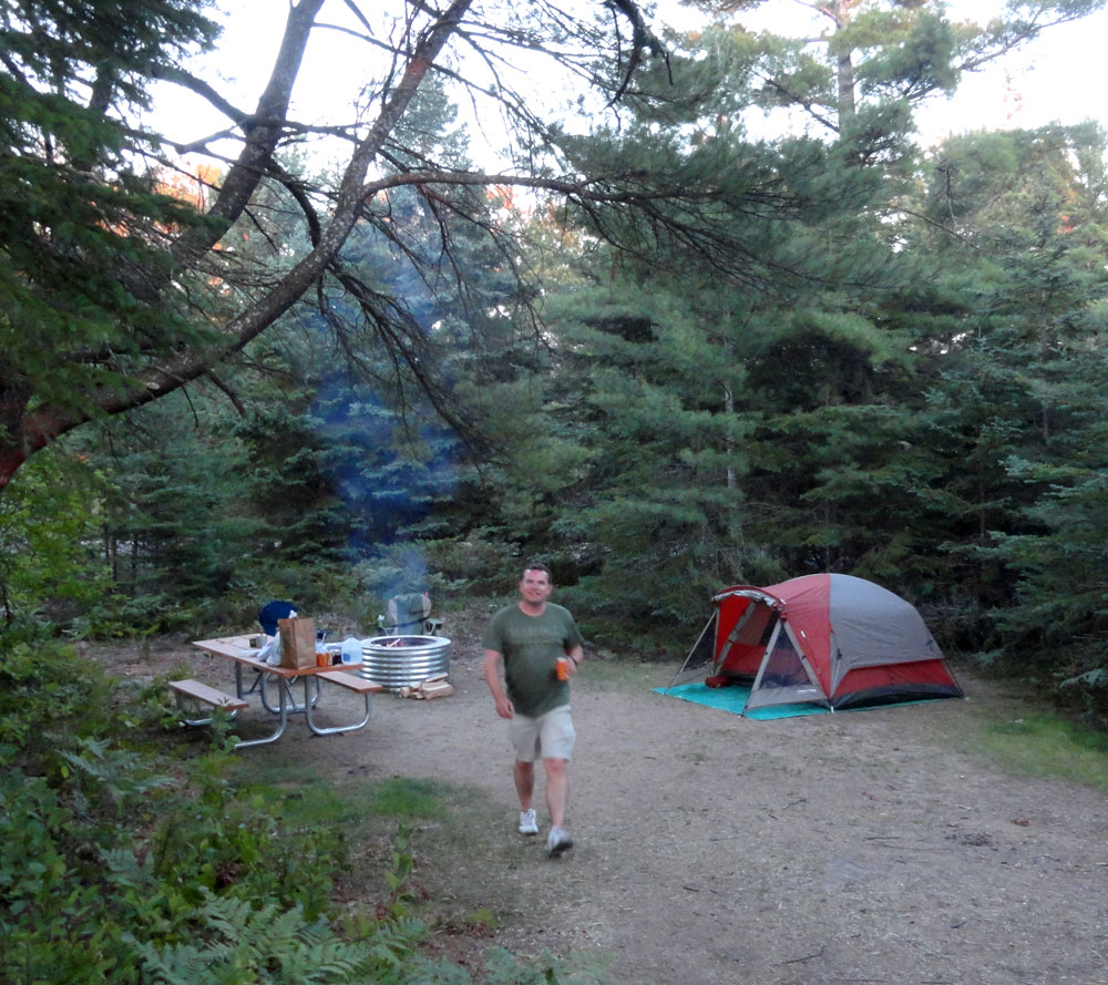
Since we were traveling from Minnesota, our journey began in Grand Portage. We stayed at the only hotel near the departure dock, the Grand Portage Lodge and Casino of the Lake Superior Chippewa Band. The building seems to be stuck in a perpetual state of construction but the rooms are comfortable and there’s an on-site restaurant and a convenience store across the road. The evening was spent loading and perfecting our backpacks. We’d done some practicing at home, but it’s still a lengthy operation to cram three nights of necessities into a bag in an orderly fashion. We each ended up hauling just under 40 pounds, which might be heavy to more experienced backpackers, but we think was pretty good for our first shot. In retrospect there are only a few things we’d have been able to leave out.
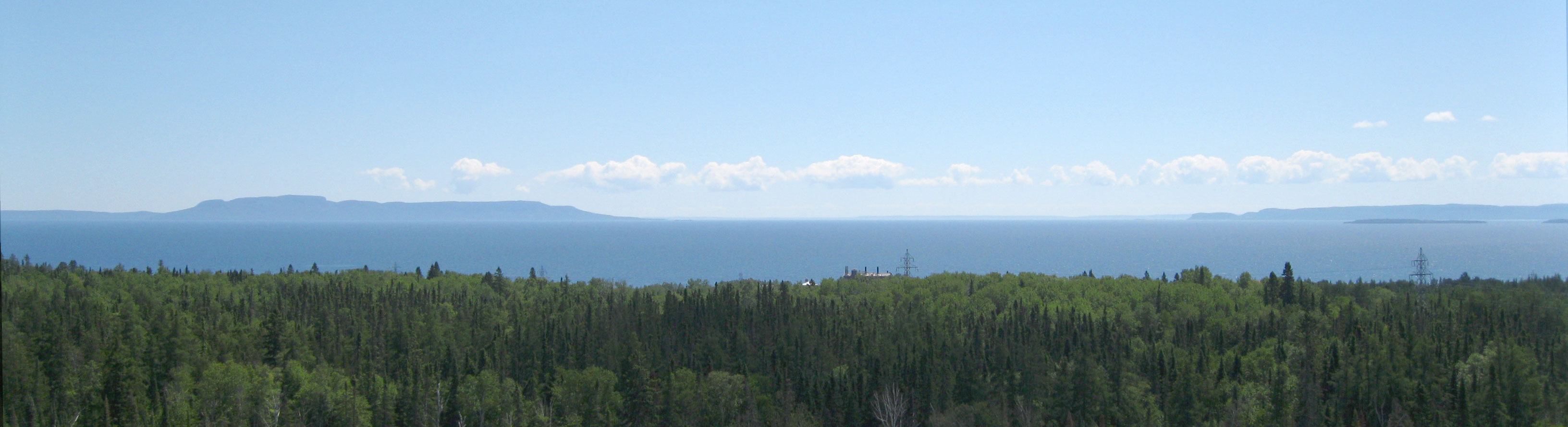
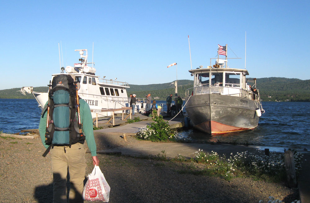
At the crack of dawn we made the short drive to the Voyageur II dock on the other side of Grand Portage Bay. All voyages to the park require advanced reservations. People were beginning to assemble when we arrived an hour before the 7:30am departure, and soon the captains showed up to check the passenger list and load baggage onto the roof. The two-hour crossing to Windigo was uneventful, with beautiful weather and smooth-ish water by Lake Superior standards. Even on a calm day the boat gets bobbed around by the big lake, so during rough water we heard it can be quite an adventure. The Rock of Ages Light is the first landmark nearing the island, standing guard over a rocky shoal off the southwestern tip. It wasn’t long before we were easing into the shelter of Washington Harbor.
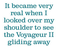
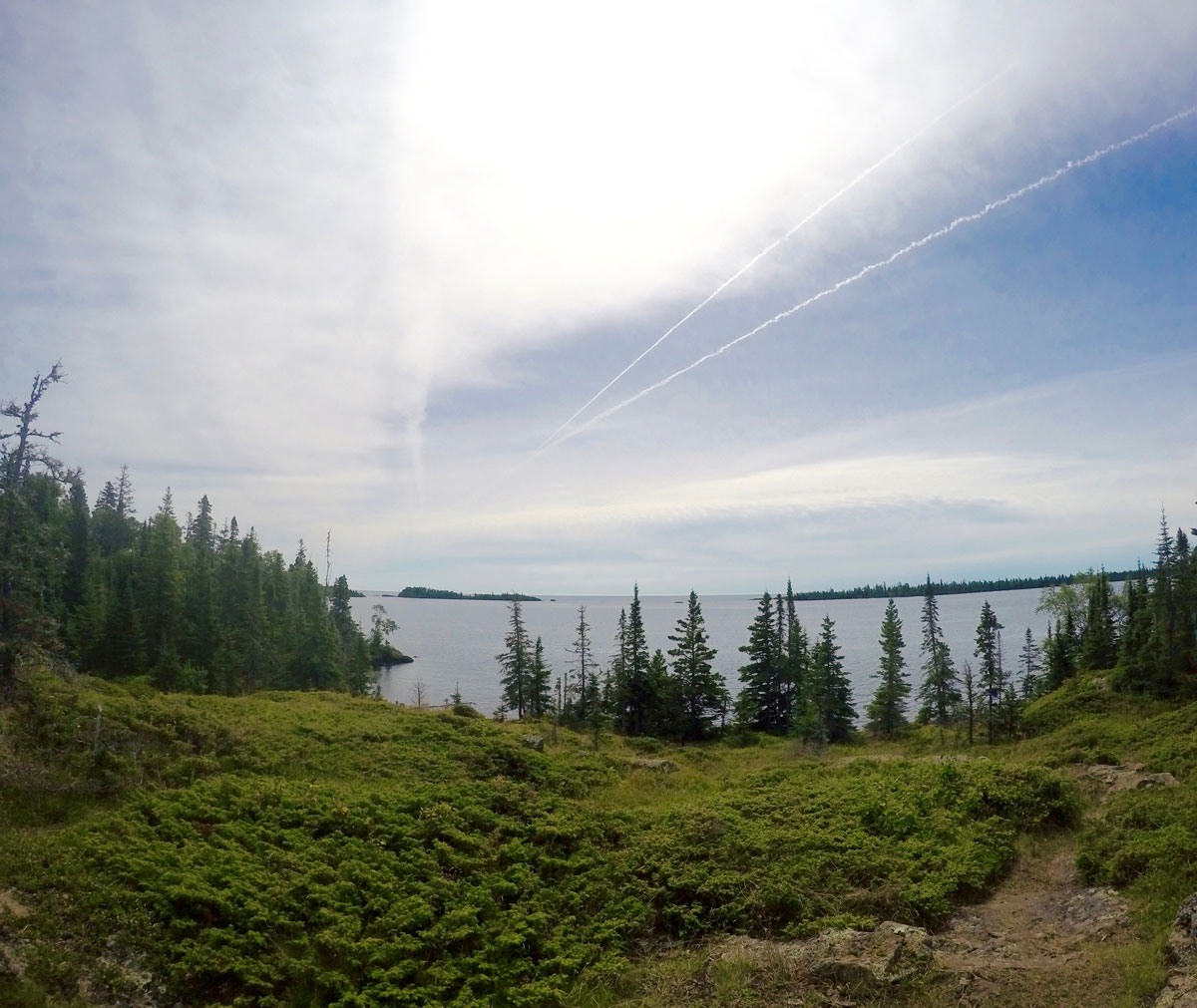
At Windigo, everyone had to exit the boat and attend the dockside briefing with Ranger Kaitlyn. This is when it got really exciting. Because we were camping, we also visited the ranger station to fill out a backcountry permit with our planned itinerary and pay our $4 per-night per-person camping fee. We re-boarded the Voyageur to make our way three more hours to our drop off point at McCargoe Cove. The route follows the northern shore past mile after mile of undisturbed forest. There’s no sign of human impact visible from
the boat. Off the left side, the Sleeping Giant lounges on the distant Canadian shore. Buoys mark the entrance to McCargoe Cove, a narrow bay that makes a diagonal slash into the interior of the island. We disembarked at the dock along with a few others and got prepared to set off into the woods. It became very real when I looked over my shoulder to see the Voyageur II gliding away. We’re really on our own now.
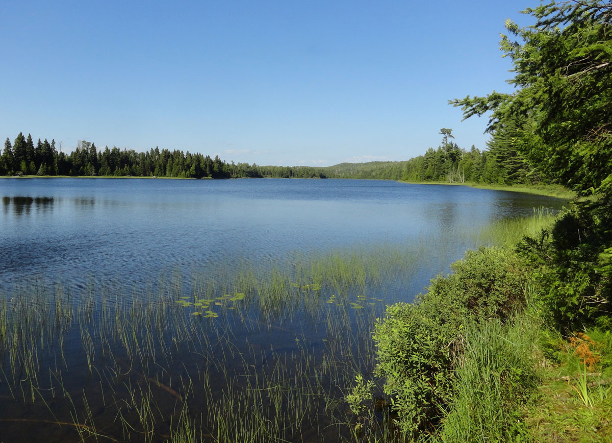
It was only a 2.5 mile hike to get to our first overnight stop, West Chickenbone Lake campground. We didn’t meet any other hikers on the way, just incredibly dense forest and total silence. Indian Portage Trail is easy to follow, but with only a few people passing by every day, there are lots of encroaching plants to plow through. After a little more than a mile, the trail begins to follow the shore of Chickenbone Lake. Our destination campground is located at the southernmost point of the V-shaped lake, just beyond a long stretch of narrow boardwalk trail. Upon arrival we found a few groups of campers already getting situated. We checked out the real estate and found campsite 2 to be a lovely, shaded plot. Having practiced our tent assembly a few times, we had the place looking habitable in no time.
After meeting some neighbors, we took a quick walk along Indian Portage Trail over the Greenstone Ridge and down to the edges of Lake Livermore and Lake LeSage. This is where the true peacefulness of Isle Royale set in. We found ourselves a half hour walk from our campsite on the largest island in the largest freshwater lake in the world. There’s no phone service, no radio, no cars, no machines, just water like glass and an occasional bird call. This is awesome.
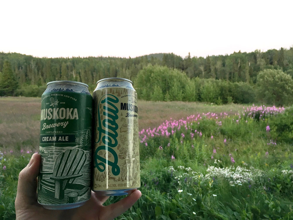
Back at camp, it was time to take care of the more practical things, mainly dinner. Our cookware consisted of camping gas and a small burner attachment, a couple pots and some space-efficient utensils. We took the advice of previous visitors and packed in dehydrated meals from the Mountain House brand. They’re compact and lightweight and require only a couple cups of boiling water to “cook” in the bag. The beef stew was actually tasty, with chunks of meat, potatoes and vegetables that plumped up nicely. We almost forgot they had been unidentifiable shriveled nuggets just ten minutes earlier. We even brought a small pack of Oreos for dessert, because we have priorities. It paled in comparison to the home-cooked meals we’d become accustomed to at the Arrowhead Lodge at Voyageurs, but it got the job done.
To fully understand the remoteness, the topic of water is a good place to start. There is a water source in each campground, but keep in mind that by “source” I don’t mean a faucet, I mean a place to dip water out of a lake. It then must either be filtered or boiled for three minutes to be clear of parasites. (Windigo and Rock Harbor have the only campgrounds
with running water.) Drinking water was probably the issue we put the most thought into. We initially thought we’d be able to pack in enough for three days and thereby avoid filtering/boiling, but quickly realized that it was unrealistic from a weight and space standpoint. We ended up packing two liters in our backpack reservoirs and four additional liters to use as drinking water for the first two days. We bought a simple filter from Sawyer so we could replenish our supply after that was used up. A filter rated at 0.4 microns or less is recommended, so we bought a 0.1 because we’re not messing around. The water in the interior lakes isn’t exactly appealing. It has a light brownish tone and a slight earthy flavor even after filtering so we used it only for cooking the first night. It might have been overkill, but we still boiled it because we were determined to not bring home any pet tapeworms.
The water source area also became the unofficial West Chickenbone social gathering space. After cleaning up dinner, we took our flasks to the water’s edge and met the nice ladies from campsite 3, a trio from Michigan and Wisconsin on an annual getaway. Soon they invited us into their card games and taught us two neither of us had played before. When the light started to fade, we knew it was time for one more deal and then we had to head to our tents. The sun stays up late that far north, but the light fades quickly once it drops, so we arranged the tent for sleeping by lantern light. Rangers highly recommend putting everything either inside the tent or secured to something outside because of thieving animals. Isle Royale foxes and squirrels have been known to run off with hikers’ shoes, and that wouldn’t be any fun.
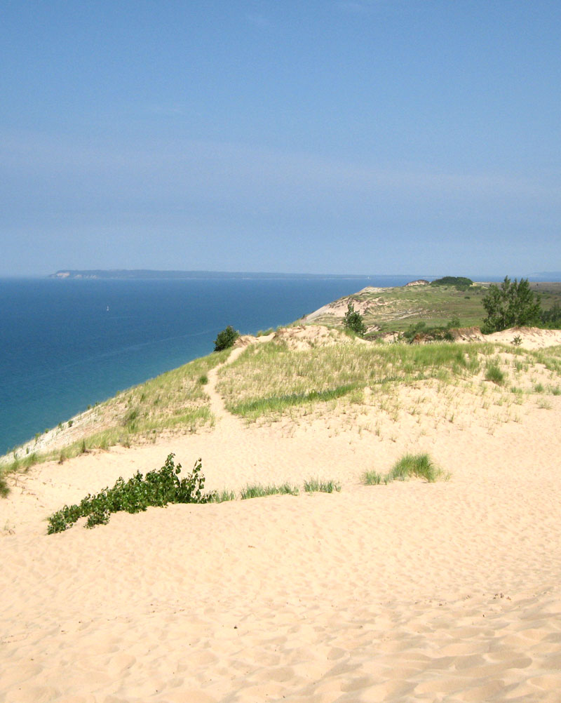
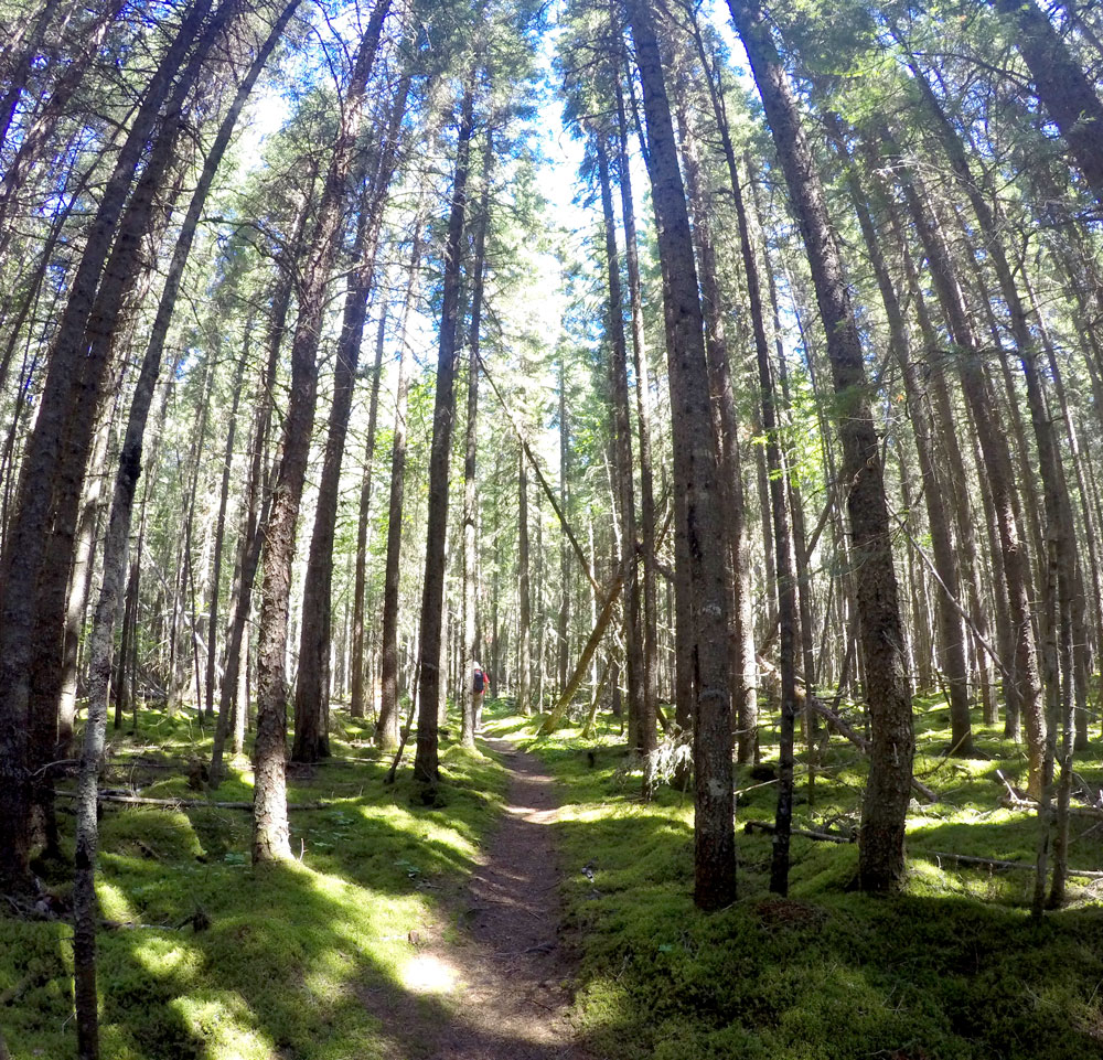
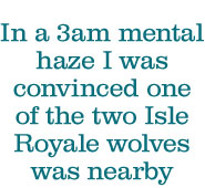
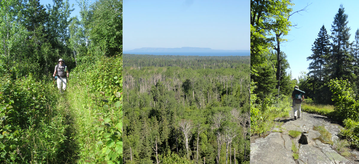
There’s nothing quite as satisfying as sleeping in nature, going to bed when the sun goes down and rising when it returns. Chickenbone Lake would be our most remote campsite by far. The only thing that woke us in the night was a strange animal howling sound. In a 3am mental haze I was convinced one of the two Isle Royale wolves was nearby, but we later found out it was just the call of a lonely loon looking for friends. At sunrise we emerged from the tent and cranked up the burner to make coffee and boil water for our dehydrated breakfast. The Mountain House scrambled eggs and bacon are surprisingly realistic. After packing up, we hiked in the direction of the Greenstone Ridge Trail. Our target destination for the day was Daisy Farm campground, eight miles away on the Lake Superior shore. Greenstone Ridge is the backbone of Isle Royale, a high spine of rock running its entire length. The name comes from Chlorastrolite, a greenish semiprecious stone found on Isle Royale that is the state gem of Michigan. A 40-mile trail traces this ridge all the way across the island from Windigo to Lookout Louise. Lots of hikers do the entire length over the course of about a week, but we only spent six miles on it. About two miles out of Chickenbone, Greenstone Ridge Trail doubles back and ascends a steep incline to the best views we’d seen yet. The exposed rocky ridge gave us a clear view across Lake Superior to Canada and a sea of uninterrupted trees and ridges below us.
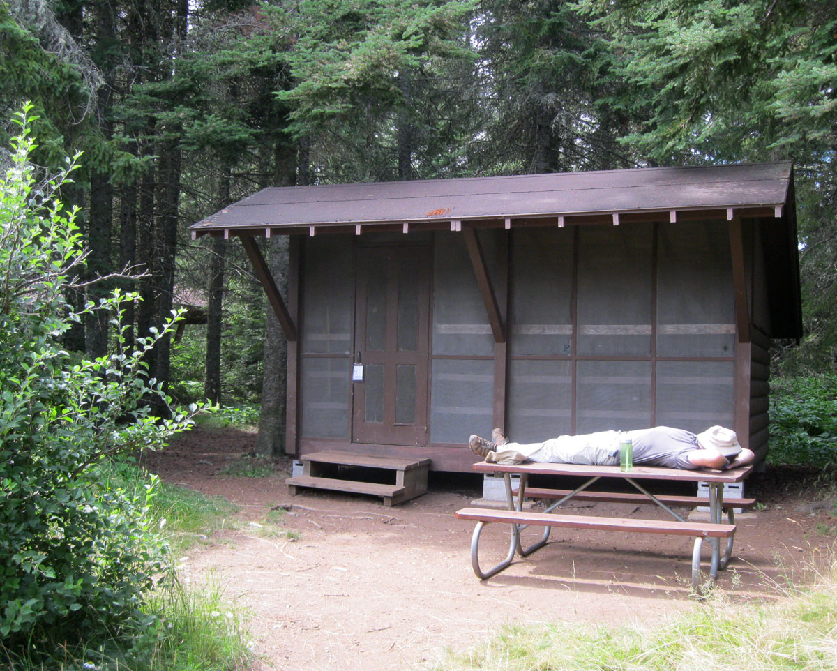
Our visit corresponded with unusually warm temperatures on the island. Normally summer highs only reach the mid 70s, but the sky was cloudless and the sun heated the interior of the island to the mid 80s. The inclines here are gentler than hikes we’ve done in the West or Alaska, but the heat combined with the 40 pounds on our backs made for tiring going. We got into the rhythm of stopping every two miles to take a summer sausage and tortilla break and drank water constantly. Six hours in, at the point where Daisy Farm Trail splits off, we had a choice between descending to the campground the short way or continuing on Greenstone Ridge to the Mount Ojibway fire tower and then taking the Mount Ojibway Trail to Daisy Farm. We might now regret this decision, but we took the easy way and missed the great view from the fire tower, but at that moment a 1.5 mile downhill walk sounded better than climbing another 400 feet in elevation to Mt. Ojibway and extending our daily mileage from 8 to 10. As it was, we teetered into Daisy Farm campground exhausted, but we got there early enough to score a camping shelter with a picnic table and everything. The lap of luxury by Isle Royale standards.
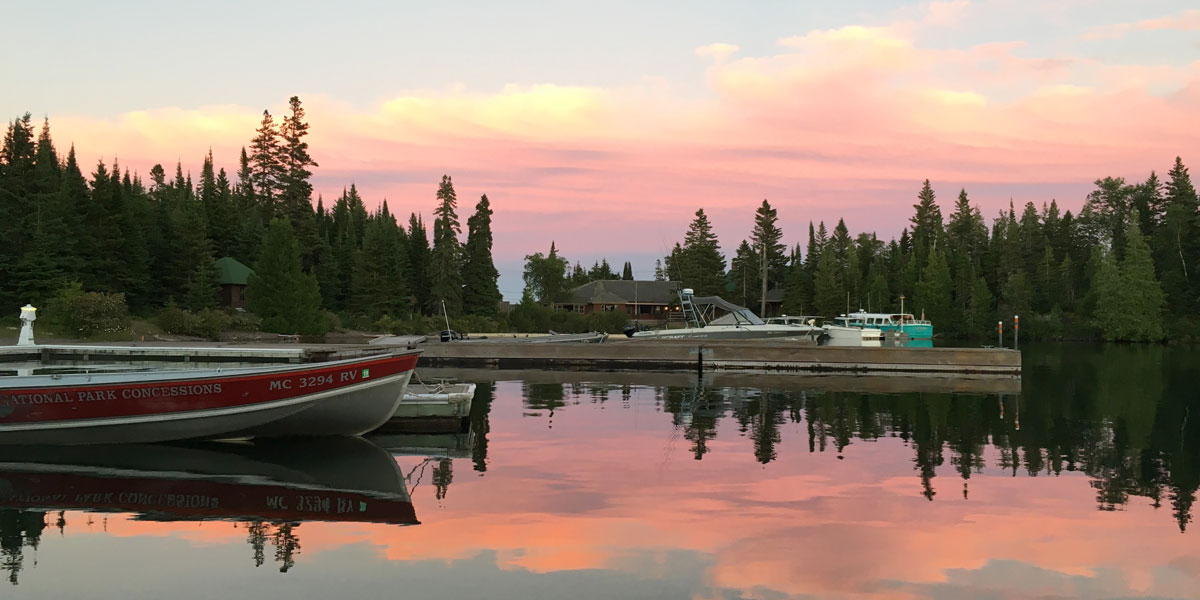
Daisy Farm is remote, but felt bustling in comparison to West Chickenbone. The ability to arrive there by boat from Rock Harbor means people staying there haven’t necessarily hiked in. After setting up in shelter 3, we joined other people gathering water from the lake. By this point, we had finished our fresh water supply and needed to filter water for drinking as well as cooking. Lake Superior water is vastly superior to that of the interior lakes, it’s chilled and crystal clear. It takes a while to squeeze 8 liters through the filter, but there’s no sense of urgency on the island and the wait provided us an opportunity to rinse out some clothes as well as ourselves. A friendly duck even joined us for a bathe. With our water supply replenished, we prepared the evening’s dinner of macaroni and cheese fancified with summer sausage chunks. Afterwards, we grabbed a spot on the Daisy Farm dock to watch the sunset while sipping bourbon. The calm evening water looked like a mirror reflecting the entire scene; an Isle Royale sunset is definitely not to be missed. Before it got too dark, we retired to the shelter. We had still set up the tent inside the 3-sided structure (the fourth side is screened) to keep any crawling things away from us in the night, but at least we didn’t have to put on the rain fly and there was plenty of space to spread out supplies without fear of ill-intentioned squirrels.
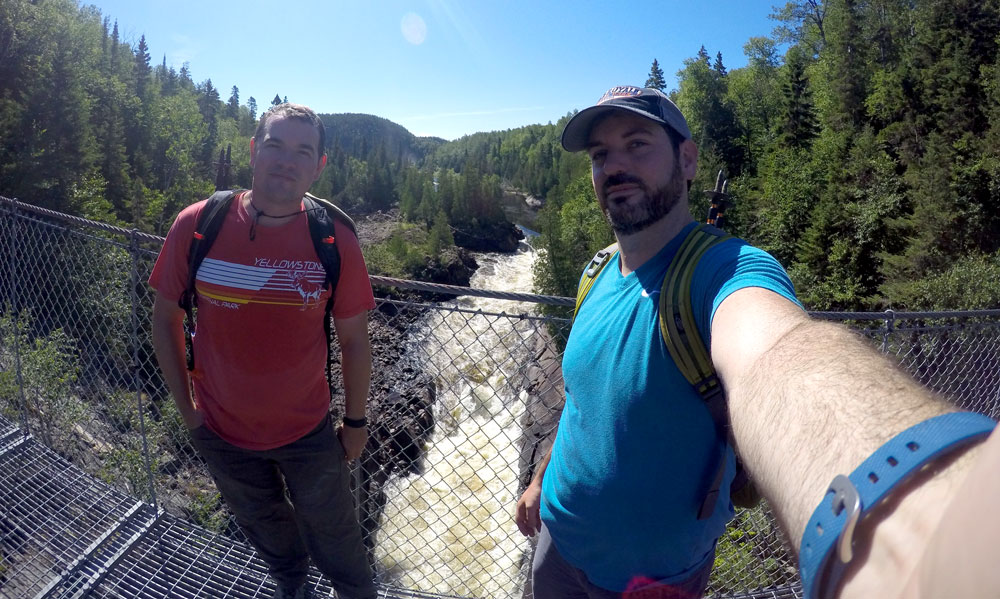
For our third day of hiking, we just had to trek seven miles to our final Isle Royale destination, Rock Harbor. The Rock Harbor Trail follows the shore of Rock Harbor the entire way, with views of the lake and outer barrier islands, including park headquarters on Mott Island and the Rock Harbor Lighthouse. This trail is much flatter than the Greenstone Ridge, but there are some rocky areas that require careful footing, so while easier, the going wasn’t much faster overall. After a couple hours, we stopped for a rest on the dock at Three Mile campground. At this point, we were within day-hiking distance of Rock Harbor, which meant we ran into a few people who had just left the lodge for a morning hike. One lady cheerily asked us “Why are you so sweaty!?” We just pointed to our backpacks and said “this”. The final push was a three mile section alternating between thick forests and rocky clearings with beautiful views of the harbor. A quick side trail up a hill leads to Suzy’s Cave, a sea cave that formed when the level of Lake Superior was much higher. Sensing the end of our journey, we practically sprinted the final mile, arriving at the Rock Harbor campground about four hours after departing Daisy Farm, giving us the whole afternoon to hang out in the most developed part of the island. We again found some vacant shelters and claimed number 8, then walked over to check out the area around Snug Harbor containing the visitor center, convenience store, docks, lodge and restaurants.
Rock Harbor is where the majority of visitors arrive and spend time on Isle Royale. It’s the docking point for the two boats from Michigan (Isle Royale Queen IV from Copper Harbor and Ranger III from Houghton) and the overnight layover for our Voyageur II from Minnesota. We poked around the visitor center and convenience store and then made a beeline for the Greenhouse Grill’s outdoor patio where we knew there
was beer waiting for us. The selections from Keweenaw Brewing hit the spot, but what we were most looking forward to was the showers. Tokens purchased from the convenience store provide five minutes of glorious hot water in the shower stalls on the back side of the restroom building. Feeling all fresh, we spent some time strolling the area before dinner, visiting Tobin Harbor on the other side of the narrow peninsula and hoping to see a moose (we never did). We went to the Lighthouse Restaurant for dinner, the slightly fancier side of the lodge dining hall. It’s the same basic ambiance, but has a wider variety of entree dishes, while the Greenhouse Grill’s menu leans more toward sandwiches and pizza. After stuffing ourselves with chicken, pork, ice cream sandwiches and wine, we went to the evening program with Ranger Lori She shared her experiences living and working on the island and taught us the language of loon calls. Yet again it was time for an amazing waterfront sunset, so we watched the show from a dock in Snug Harbor.
The night was restful as usual but we stepped out of the shelter around 3:00 to see the Milky Way. In the morning we enjoyed a non-dehydrated breakfast at the Greenhouse Grill and waited for the Voyageur II to be prepped for the 9:00am departure. Cruising along the southern shore after having hiked across the island, we had a totally different perspective than when we arrived four days earlier. It was seven hours by boat from Rock Harbor back to Grand Portage, Minnesota, with brief stops at park headquarters, Chippewa Harbor and Windigo. Ranger Kaitlyn was there on the same Windigo dock where she’d given us our welcome intro, but now she was doing her best pageant wave as we floated away. An hour from shore, my phone picked up a cellular signal from Canada and our seclusion was officially over. We hadn’t missed the outside world one bit while we were away, proof of just how engaging Isle Royale is.
Up next: Oh Canada!
Previously: Apostle Islands, Voyageurs and Grand Portage
View the whole gallery of images from our trip here.
Our journey, as always, began by making our way out of the city of Chicago. The first destination was Apostle Islands National Lakeshore, a 7.5 hour drive away at the northern tip of Wisconsin. It went smoothly except that the highway system in Ashland County was a washed-out mess from a major rainstorm a few weeks prior. Instead of following a marked detour, we trusted that Google Maps had found a way around the road closures and ended up trapped in a maze of gravel roads and barricades for a while before finding a passable route. Minor setback aside, it was an easy day and we arrived in Bayfield, Wisconsin just in time.
Approaching Bayfield we got our first view of mighty Lake Superior, which would be in our sights the majority of this trip. Bayfield is home to the main visitor center of Apostle Islands, and is the best place to begin exploration. We booked the three-hour Evening Grand Tour through Apostle Islands Cruises that left the dock at 5:30. The 55-mile route weaves between many of the 21 islands protected in the national lakeshore. Captain “Frosty” provided a running commentary, telling each island’s history as well as personal anecdotes from his life in the area. The highlight of the excursion was Devils Island, where a lighthouse and colorful sea caves face the full expanse of the largest freshwater lake on the planet. The weather was perfectly calm during our tour, but during storms the waves can wash right up over the high wall of rock and onto the lighthouse lawn. The captain steered the boat close to shore, even pulling into a small cove where we could almost touch the sides. After the crowd ooh’d and aah’d sufficiently we turned back toward Bayfield, passing the quaint Raspberry Island Lighthouse before pulling up to the Bayfield dock after sunset.
A quick search of area restaurants pointed us to Ethel’s at 250 for dinner. We called ahead to make sure they’d be open after our late boat tour and they were happy to welcome us at 9:30. The fresh-caught whitefish, homemade pastas and super-friendly service hit the spot after our long day. Afterwards we enjoyed a couple beers at the new Creamery Bar, where they had our favorite New Glarus brews on tap. We spent the night at Seagull Bay Motel, with lake views described as “Super-Duper” by the owner. The scenery was lovely, but the weather that night was not so super-duper. A violent thunderstorm at 3:00am brought a a lightning show like a strobe light and 60-mph winds that knocked out power. That outage made the next morning somewhat of an adventure. We had coasted into town on fumes
they day before and now were unable to find an open gas station. A ranger at the Apostle Islands visitor center informed us that most of Bayfield County was likely without power and our best bet was to head 12 miles south to the next town. The fuel range readout was in the single digits and we were dangerously low on caffeine when we pulled into Washburn, but one gas station had operating pumps and we found a darkened cafe across the street serving pastries and drip coffee. Crisis averted. We had hoped to drive scenic Wisconsin 13 around the Bayfield Peninsula, but decided not to press our luck and chose the more-traveled way toward Minnesota on US 2. Luckily all the bad weather got out of our way in those first 24 hours and we had smooth sailing (literally) the rest of the trip.
Our next destination, and first National Park of the trip was Voyageurs, tucked up along the Canadian border in Northern Minnesota. It’s a about a three-hour drive from Duluth. Along the way, we enjoyed a fresh lunch at Natural Harvest Food Co-op in Virginia, Minnesota. Arriving at Voyageurs in the early afternoon, we had time to get settled at Arrowhead Lodge (more on the lodge later) before heading to the nearby Kabetogama Lake Visitor Center for our afternoon/evening ranger-guided Kettle Falls Cruise. Schedules for this cruise vary by season, but the 3:00-8:30pm time was the only one offered on Thursdays. Ranger Gary piloted the 18-passenger pontoon boat and Ranger Kevin handled the interpretation and wildlife spotting duties. This is their favorite tour because of the less-crowded hour at the Kettle Falls Lodge and the low evening sun on the return trip. The first two hours are spent exploring the various inlets and islands of Kabetogama Lake. Birds were the main wildlife attraction, with many bald eagles spotted high in the trees. On the water and in the air we saw ducks, pelicans, gulls, cormorants and loons (Minnesota’s state bird). Entering Namakan Lake we
viewed Canadian islands to the right and American shore to the left. At the Kettle Falls dock, Kevin led us through the woods to the historic Kettle Falls Lodge, which has been welcoming guests in this remote location since 1910. Early visitors were mostly related to the logging industry, but around the mid-20th century the focus shifted to tourism. You can still rent a room or cabins there, 15 miles from the nearest road and a stone’s throw from Canada. We settled in the lodge dining room, where we enjoyed a dinner of local fried walleye and wild rice. We peeked in the upstairs guest rooms and the famously saggy-
floored saloon before walking to the Kettle Falls Dam with the rangers. Here, you can see the power of the water as it thunders down from Namakan Lake into Rainy Lake. It was this water power that inspired a failed 1920s plan to turn the entire region into a series of unnatural, controlled lagoons to be harnessed for hydroelectric power. Lucky for us, only the small Kettle Falls Dam and nearby Squirrel Falls Dam were built, leaving the largely pristine region of today. Back on the pontoon after a couple hours on land, we journeyed back to the visitor center, taking an alternate route with some different sights. The rangers pointed out logging relics and resort locations from before the creation of the national park that have since been returned to the wild, a good reminder of the human impact of the area and nature’s ability to restore itself.
The next day’s plan was to visit Locator Lake, in the Kabetogama Peninsula portion of the park. Canoes are available for rent from the Park Service, so we reserved one a few weeks in advance and picked up the key from the Kabetogama Visitor Center that morning. The Locator Lake trailhead is at a dock across Kabetogama Lake, so getting there was up to us. We chose to use the kayaks available from Arrowhead Lodge, but alternatively you can hire a boat or arrive by private vessel. It was a three-mile paddle through the Grassy Islands
and across some open water stretches to the trailhead. Once there, we hauled our kayaks onto the dock and set off on the two-mile hike to locator lake. The moderately hilly trail passes through dense woods and a giant beaver pond and takes about an hour. Upon arrival, we found two racks of stashed canoes, selected the one that matched our key and eased it into the water. Locator Lake is a little more than a mile long by maybe 1,000 feet wide, and connects to the similarly-sized War Club Lake through a narrow strait. We spent about an hour and a half rowing around the lakes before returning to the dock to enjoy our packed lunches in solitude. After that it was time to lock up the canoe and head back to our kayaks at the other end of the trail. It’s a bit tricky to get back into a kayak from a dock a few feet above the water, so we were happy to have some friendly campers nearby to help us shove off. Another hour and fifteen minutes through choppy water brought us back to the Arrowhead Lodge for an evening of total relaxation.
Saturday morning we woke with sore shoulders from the previous day’s manual labor. Good thing we planned to rent a motor boat from the lodge. Our craft was a 16-foot fishing boat with a 30hp outboard motor. Larry the boatmaster gave us a map and spent some time pointing out the best route, but the look on his face said “I might be coming to rescue you later today”. Kabetogama Lake is a tricky place to navigate, with many small islands
and lots of rocks submerged just below the surface. We made our destination the Ash River Visitor Center 11 miles distant and sped away from the dock into the open water. Buoys mark the safe channels down the center of the lake, making it like playing a giant game of connect the dots. The only problem is that they are so far apart that it is difficult to see the next buoy in line. With Nick posted at the middle seat with the map, I steered us from the tiller in the back. Driving was somewhat stressful at first, but became fun after we figured out our navigating strategy. An hour and fifteen
minutes later, we tied up to the dock at the Ash River Visitor Center. We could have gotten there by car in less than half the time, but it’s so much cooler to show up in a boat. A park ranger told us about some hikes in the area and we selected the Blind Ash Bay Trail. It’s a three-mile round trip with a loop through a tall forest of red pines at the far end. Along the way are several overlooks of the lake from high bluffs, which was cool because up to that point we had only seen Kabetogama from water level. Back at Ash River, we ate our lunch at a shoreside picnic table and then motored off toward our next destination, Ellsworth Rock Gardens. Located
across the lake, these gardens are the work of Jack Ellsworth, a contractor from Chicago who had a summer home there from 1944 through the 1965. He began his creation by stacking rocks to create 62 terraced flowerbeds atop a granite outcropping. Later, he decorated the beds with abstract rock sculptures, ponds and a teepee. After he was unable to tend them, the gardens became overgrown for almost 30 years before efforts began in 1996 to clear the brush and restore the former beauty. It’s a quirky site that was worth the detour. Upon our return to Arrowhead, we had successfully navigated our boat through about 24 miles of Kabetogama Lake’s waters without Larry having to come rescue us.
Our stay for the entire three nights was the previously-mentioned Arrowhead Lodge. We compared several lodges in the area and selected Arrowhead because it offers everything we could think of, from lodging to dining to boat rentals. There are various cabins on the property, but we chose to rent a lodge room upstairs in the main building. Our quarters overlooked the lake, the bathrooms were just down the hall and we had the whole floor mostly to ourselves. The lack of locks on the doors reminded us what a laid back part of the country we were in. The whole operation is family-run, with mother/daughter duo Betsey and Sally being the main hosts. They offer all meals and we took full advantage, eating breakfast all three mornings, dinner on two nights and ordering packed to-go lunches on both of our boating days. All the food was home-cooked and delicious and the desserts were amazing. When we arrived for each meal, our favorite table in the screened porch was already set for us. A draft beer in a frosty mug also hit the spot after a long day in the park. Decker, the family yellow lab was the icing on the cake, greeting us each time we returned to the lodge and seeing us off from the dock when we departed. Overall, Arrowhead Lodge really turned out to be one of our favorite places we’ve ever stayed on the road, and we’d soon be missing the hospitality while camping in the wilderness.
Between Voyageurs and the upcoming Isle Royale excursion we drove across woodsy northern Minnesota. We stopped for lunch and an emergency hiking boot purchase in Ely before taking Minnesota 61 along the Lake Superior shore to Grand Portage National Monument. There’s an incredible amount of Native American and fur trade era history in this little corner of Minnesota, and it’s well represented at the monument. The Heritage Center contains artifacts and an informative movie. Across the street the Historic Depot features the rebuilt Great Hall, kitchen and canoe warehouse along with an Ojibwe village and voyageurs camp. Interpreters in period costume explain the functions of each area and bring the story to life. We’re not always fans of costumed interpreters, but at Grand Portage, they really added to the experience. Before we settled in at the Grand Portage Lodge for the night, we took the one-mile trail to the lookout at the top of Mt. Rose. From there we had a spectacular panorama of the Monument, and Grand Portage Bay. Out on the horizon in Lake Superior we got our first glimpse of Isle Royale, more than 20 miles away. Time to get the packs loaded up.
Up next: Backpacking Isle Royale National Park
View the whole gallery of images from our trip here.
You must be logged in to post a comment.