
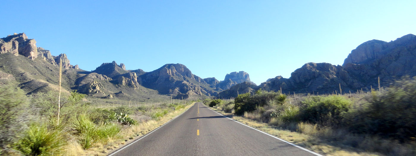
Our journey, as always, began by making our way out of the city of Chicago. The first destination was Apostle Islands National Lakeshore, a 7.5 hour drive away at the northern tip of Wisconsin. It went smoothly except that the highway system in Ashland County was a washed-out mess from a major rainstorm a few weeks prior. Instead of following a marked detour, we trusted that Google Maps had found a way around the road closures and ended up trapped in a maze of gravel roads and barricades for a while before finding a passable route. Minor setback aside, it was an easy day and we arrived in Bayfield, Wisconsin just in time.

Devils Island Light and sea caves at the northernmost point in Wisconsin.
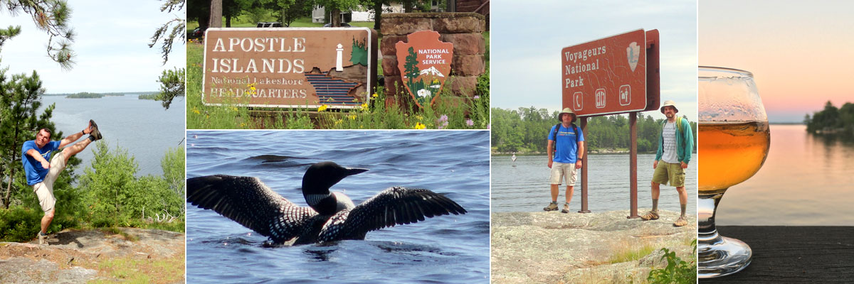
Approaching Bayfield we got our first view of mighty Lake Superior, which would be in our sights the majority of this trip. Bayfield is home to the main visitor center of Apostle Islands, and is the best place to begin exploration. We booked the three-hour Evening Grand Tour through Apostle Islands Cruises that left the dock at 5:30. The 55-mile route weaves between many of the 21 islands protected in the national lakeshore. Captain “Frosty” provided a running commentary, telling each island’s history as well as personal anecdotes from his life in the area. The highlight of the excursion was Devils Island, where a lighthouse and colorful sea caves face the full expanse of the largest freshwater lake on the planet. The weather was perfectly calm during our tour, but during storms the waves can wash right up over the high wall of rock and onto the lighthouse lawn. The captain steered the boat close to shore, even pulling into a small cove where we could almost touch the sides. After the crowd ooh’d and aah’d sufficiently we turned back toward Bayfield, passing the quaint Raspberry Island Lighthouse before pulling up to the Bayfield dock after sunset.
A quick search of area restaurants pointed us to Ethel’s at 250 for dinner. We called ahead to make sure they’d be open after our late boat tour and they were happy to welcome us at 9:30. The fresh-caught whitefish, homemade pastas and super-friendly service hit the spot after our long day. Afterwards we enjoyed a couple beers at the new Creamery Bar, where they had our favorite New Glarus brews on tap. We spent the night at Seagull Bay Motel, with lake views described as “Super-Duper” by the owner. The scenery was lovely, but the weather that night was not so super-duper. A violent thunderstorm at 3:00am brought a a lightning show like a strobe light and 60-mph winds that knocked out power. That outage made the next morning somewhat of an adventure. We had coasted into town on fumes they day before and now were unable to find an open gas station. A ranger at the Apostle Islands visitor center informed us that most of Bayfield County was likely without power and our best bet was to head 12 miles south to the next town. The fuel range readout was in the single digits and we were dangerously low on caffeine when we pulled into Washburn, but one gas station had operating pumps and we found a darkened cafe across the street serving pastries and drip coffee. Crisis averted. We had hoped to drive scenic Wisconsin 13 around the Bayfield Peninsula, but decided not to press our luck and chose the more-traveled way toward Minnesota on US 2. Luckily all the bad weather got out of our way in those first 24 hours and we had smooth sailing (literally) the rest of the trip.

Pelicans, Cormorants and Gulls, oh my.
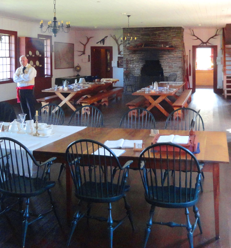
Our next destination, and first National Park of the trip was Voyageurs, tucked up along the Canadian border in Northern Minnesota. It’s a about a three-hour drive from Duluth. Along the way, we enjoyed a fresh lunch at Natural Harvest Food Co-op in Virginia, Minnesota. Arriving at Voyageurs in the early afternoon, we had time to get settled at Arrowhead Lodge (more on the lodge later) before heading to the nearby Kabetogama Lake Visitor Center for our afternoon/evening ranger-guided Kettle Falls Cruise. Schedules for this cruise vary by season, but the 3:00-8:30pm time was the only one offered on Thursdays. Ranger Gary piloted the 18-passenger pontoon boat and Ranger Kevin handled the interpretation and wildlife spotting duties. This is their favorite tour because of the less-crowded hour at the Kettle Falls Lodge and the low evening sun on the return trip. The first two hours are spent exploring the various inlets and islands of Kabetogama Lake. Birds were the main wildlife attraction, with many bald eagles spotted high in the trees. On the water and in the air we saw ducks, pelicans, gulls, cormorants and loons (Minnesota’s state bird). Entering Namakan Lake we  viewed Canadian islands to the right and American shore to the left. At the Kettle Falls dock, Kevin led us through the woods to the historic Kettle Falls Lodge, which has been welcoming guests in this remote location since 1910. Early visitors were mostly related to the logging industry, but around the mid-20th century the focus shifted to tourism. You can still rent a room or cabins there, 15 miles from the nearest road and a stone’s throw from Canada. We settled in the lodge dining room, where we enjoyed a dinner of local fried walleye and wild rice. We peeked in the upstairs guest rooms and the famously saggy-
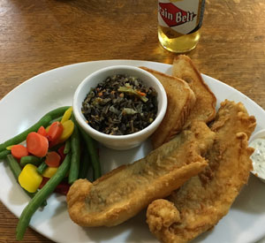 floored saloon before walking to the Kettle Falls Dam with the rangers. Here, you can see the power of the water as it thunders down from Namakan Lake into Rainy Lake. It was this water power that inspired a failed 1920s plan to turn the entire region into a series of unnatural, controlled lagoons to be harnessed for hydroelectric power. Lucky for us, only the small Kettle Falls Dam and nearby Squirrel Falls Dam were built, leaving the largely pristine region of today. Back on the pontoon after a couple hours on land, we journeyed back to the visitor center, taking an alternate route with some different sights. The rangers pointed out logging relics and resort locations from before the creation of the national park that have since been returned to the wild, a good reminder of the human impact of the area and nature’s ability to restore itself.
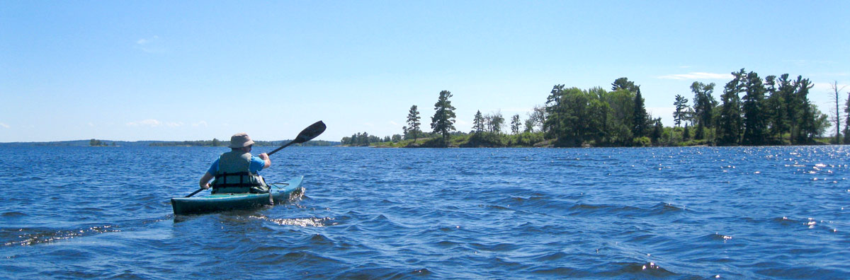
Kayaking across the expanse of Kabetogama Lake.
The next day’s plan was to visit Locator Lake, in the Kabetogama Peninsula portion of the park. Canoes are available for rent from the Park Service, so we reserved one a few weeks in advance and picked up the key from the Kabetogama Visitor Center that morning. The Locator Lake trailhead is at a dock across Kabetogama Lake, so getting there was up to us. We chose to use the kayaks available from Arrowhead Lodge, but alternatively you can hire a boat or arrive by private vessel. It was a three-mile paddle through the Grassy Islands  and across some open water stretches to the trailhead. Once there, we hauled our kayaks onto the dock and set off on the two-mile hike to locator lake. The moderately hilly trail passes through dense woods and a giant beaver pond and takes about an hour. Upon arrival, we found two racks of stashed canoes, selected the one that matched our key and eased it into the water. Locator Lake is a little more than a mile long by maybe 1,000 feet wide, and connects to the similarly-sized War Club Lake through a narrow strait. We spent about an hour and a half rowing around the lakes before returning to the dock to enjoy our packed lunches in solitude. After that it was time to lock up the canoe and head back to our kayaks at the other end of the trail. It’s a bit tricky to get back into a kayak from a dock a few feet above the water, so we were happy to have some friendly campers nearby to help us shove off. Another hour and fifteen minutes through choppy water brought us back to the Arrowhead Lodge for an evening of total relaxation.
Saturday morning we woke with sore shoulders from the previous day’s manual labor. Good thing we planned to rent a motor boat from the lodge. Our craft was a 16-foot fishing boat with a 30hp outboard motor. Larry the boatmaster gave us a map and spent some time pointing out the best route, but the look on his face said “I might be coming to rescue you later today”. Kabetogama Lake is a tricky place to navigate, with many small islands and lots of rocks submerged just below the surface. We made our destination the Ash River Visitor Center 11 miles distant and sped away from the dock into the open water. Buoys mark the safe channels down the center of the lake, making it like playing a giant game of connect the dots. The only problem is that they are so far apart that it is difficult to see the next buoy in line. With Nick posted at the middle seat with the map, I steered us from the tiller in the back. Driving was somewhat stressful at first, but became fun after we figured out our navigating strategy. An hour and fifteen
 minutes later, we tied up to the dock at the Ash River Visitor Center. We could have gotten there by car in less than half the time, but it’s so much cooler to show up in a boat. A park ranger told us about some hikes in the area and we selected the Blind Ash Bay Trail. It’s a three-mile round trip with a loop through a tall forest of red pines at the far end. Along the way are several overlooks of the lake from high bluffs, which was cool because up to that point we had only seen Kabetogama from water level. Back at Ash River, we ate our lunch at a shoreside picnic table and then motored off toward our next destination, Ellsworth Rock Gardens. Located
 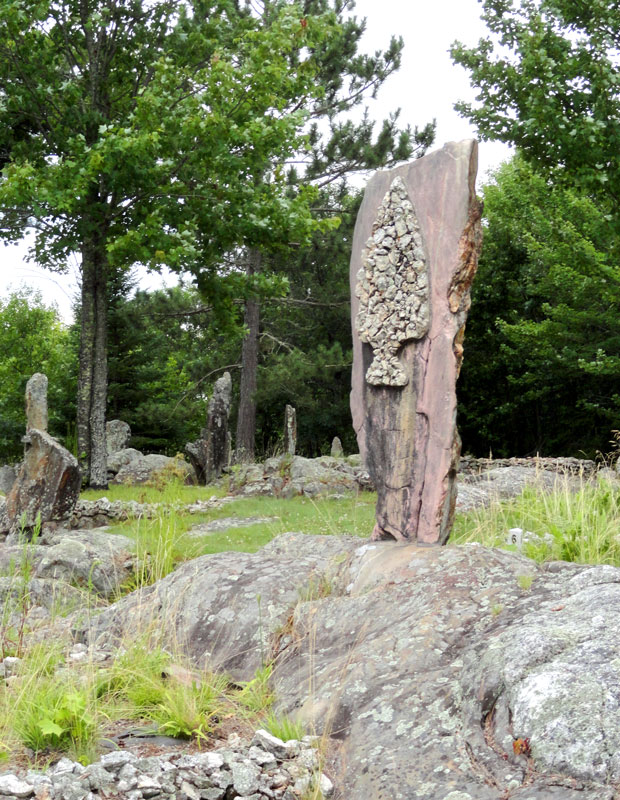 across the lake, these gardens are the work of Jack Ellsworth, a contractor from Chicago who had a summer home there from 1944 through the 1965. He began his creation by stacking rocks to create 62 terraced flowerbeds atop a granite outcropping. Later, he decorated the beds with abstract rock sculptures, ponds and a teepee. After he was unable to tend them, the gardens became overgrown for almost 30 years before efforts began in 1996 to clear the brush and restore the former beauty. It’s a quirky site that was worth the detour. Upon our return to Arrowhead, we had successfully navigated our boat through about 24 miles of Kabetogama Lake’s waters without Larry having to come rescue us.
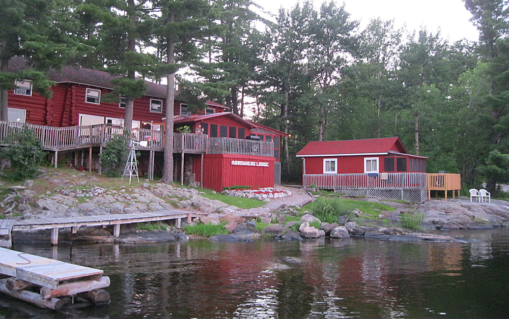
Arrowhead Lodge viewed from the dock.
Our stay for the entire three nights was the previously-mentioned Arrowhead Lodge. We compared several lodges in the area and selected Arrowhead because it offers everything we could think of, from lodging to dining to boat rentals. There are various cabins on the property, but we chose to rent a lodge room upstairs in the main building. Our quarters overlooked the lake, the bathrooms were just down the hall and we had the whole floor mostly to ourselves. The lack of locks on the doors reminded us what a laid back part of the country we were in. The whole operation is family-run, with mother/daughter duo Betsey and Sally being the main hosts. They offer all meals and we took full advantage, eating breakfast all three mornings, dinner on two nights and ordering packed to-go lunches on both of our boating days. All the food was home-cooked and delicious and the desserts were amazing. When we arrived for each meal, our favorite table in the screened porch was already set for us. A draft beer in a frosty mug also hit the spot after a long day in the park. Decker, the family yellow lab was the icing on the cake, greeting us each time we returned to the lodge and seeing us off from the dock when we departed. Overall, Arrowhead Lodge really turned out to be one of our favorite places we’ve ever stayed on the road, and we’d soon be missing the hospitality while camping in the wilderness.
Inside the rebuilt Great Hall.
Between Voyageurs and the upcoming Isle Royale excursion we drove across woodsy northern Minnesota. We stopped for lunch and an emergency hiking boot purchase in Ely before taking Minnesota 61 along the Lake Superior shore to Grand Portage National Monument. There’s an incredible amount of Native American and fur trade era history in this little corner of Minnesota, and it’s well represented at the monument. The Heritage Center contains artifacts and an informative movie. Across the street the Historic Depot features the rebuilt Great Hall, kitchen and canoe warehouse along with an Ojibwe village and voyageurs camp. Interpreters in period costume explain the functions of each area and bring the story to life. We’re not always fans of costumed interpreters, but at Grand Portage, they really added to the experience. Before we settled in at the Grand Portage Lodge for the night, we took the one-mile trail to the lookout at the top of Mt. Rose. From there we had a spectacular panorama of the Monument, and Grand Portage Bay. Out on the horizon in Lake Superior we got our first glimpse of Isle Royale, more than 20 miles away. Time to get the packs loaded up.
Up next: Backpacking Isle Royale National Park
View the whole gallery of images from our trip here.
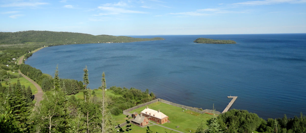
View from the top of Mt. Rose. Great Hall of Grand Portage National Monument in the foreground, Hat Point is to the left. Isle Royale is the sliver of land barely visible on the center horizon.


You must be logged in to post a comment.