2015 Year In Review

After ringing in the year 2015 in Santiago, Chile, we spent the first few days of January exploring the Atacama Desert. Hiking an 18,000ft volcano and visiting the world’s 3rd largest collection of geysers were highlights. Our spring break was a tropical one, covering south Florida and the Cayman Islands. Over three weeks in June and July we completed our longest road trip of all time at 4,572 miles, during which we visited 10 states and 8 national parks. Late summer took us to Baltimore and Washington DC, with side visits to Pittsburgh and Detroit. In the fall we stayed local, spending a long weekend across the lake in western Michigan taking in the area’s fantastic craft beer scene. Looking back, 2015 was perhaps our busiest travel year yet. From swimming with stingrays to off-roading in a Jeep, it was a wild one as well. Just wait and see if we can top it in 2016!

2015YearInReview

Posted in Destinations, Maps | Tagged , , , , , | Leave a comment

High Kick’s Best of 2015 List

Dining and drinking are always top-of-mind while we travel, so it’s no surprise many of our road trip memories revolve around tables and bar stools. When something especially good catches our attention, we write it down. Now at the end of the year, we look back and remember which ones still stand out in our minds. Our 2015 selections cover ground from Utah to Baltimore, all the way down to the tip of Florida and even into the Caribbean. 15 dishes, 10 beverages and our favorite overall meals, bars and hotels.
Here they are in chronological order:

FOOD
1 Especialidad de la Casa Chicken – Havana 1957: Miami Beach, FL
2 Pulpo (charred octopus) – Azur: Key West, FL
3 Cayman-Style Flounder – Vivine’s Kitchen: Gun Bay, Cayman Islands
4 Salmon – Brazen Open Kitchen: Dubuque, IA
5 Maple Bacon Frozen Custard – Culver’s for Beer Bacon & Cheese Fest: New Glarus, WI
6 Buratta – Pullman: Iowa City, IA
7 Elk Shepherd’s Pie – Metate Room: Mesa Verde National Park, CO
8 The Sirloin – Swingin’ Steak: Mexican Hat, UT
9 Smoked BBQ Pork Ribs – Rim Rock Restaurant: Torrey, UT
10 Fried Zucchini – Jeffrey’s Steakhouse: Moab, UT
11 Bacon Flight – The Berkshire: Denver, CO
12 Crab Tart – Woodberry Kitchen: Baltimore, MD
13 Entrecôte de Boeuf – Antietam: Detroit, MI
14 The Mudgie – Mudgies Deli: Detroit, MI
15 Breakfast Frittata – Terra: Grand Rapids, MI

DRINK
16 Key Limeade – Buttonwood Cafe: Everglades National Park, FL
17 Desert Nectar Smoothie – Peace Tree Juice Cafe: Moab, UT
18 Manhattan – Ghost Bar: Moab, UT
19 Coral White Cabernet Sauvignon – Colterris Wines: Palisade, CO
20 Dirty Hippie Dark American Wheat – Palisade Brewing: Palisade, CO
21 Caramel Pecan Coffee Stout – Lena Brewing: Lena, IL
22 Barrel Aged Apple Cort – Butcher and the Rye: Pittsburgh, PA
23 Victory Dance – Butcher and the Rye: Pittsburgh, PA
24 Dragon’s Milk Bourbon Barrel Stout – New Holland Brewing: Holland, MI
25 Pepper in the Rye Ale – Brewery Vivant: Grand Rapids, MI

MEAL OF THE YEAR – Antietam: Detroit, MI
Runners Up:
Azur: Key West, FL
Brazen Open Kitchen: Dubuque, IA

BAR OF THE YEAR – Butcher and the Rye: Pittsburgh, PA
Runners Up:
The Sugar House: Detroit, MI
Baxa’s Sutliff Tavern: Sutliff, IA

HOTEL OF THE YEAR – NYAH: Key West, FL
Runners Up:
Far View Lodge: Mesa Verde National Park, CO
Inca Inn: Moab, UT
Atheneum Suites Hotel: Detroit, MI

Posted in Maps, Travel Resources | Tagged , , , , | Leave a comment

Spring Break 2016 Destination Reveal

TexasNewMexico_Animation_v2

Winter may be just around the corner, but we’re already looking forward to our spring break 2016 adventure. We’re heading to Texas and New Mexico to visit our 39th, 40th and 41st National Parks: Big Bend, Guadalupe Mountains and Carlsbad Caverns. This region has come up on our drawing board before but been passed over due to time/distance issues or invitations from friends temporarily living on tropical islands. Weather is an important factor here, as the heat at Big Bend is nearly intolerable in the summer, making a “cool” season visit ideal. Even in April, average high temperatures should be in the low 90s.

It’s not an easy region to get to. Flight options from Chicago to Dallas-Fort Worth or Houston are practically limitless, but Texas is so huge, those cities are a full day’s drive from where we’re going. The nearest airports are at Midland and El Paso, each still more than 3.5 hours from Big Bend. As a result of some creative and flexible scheduling, we’ll fly to Texas separately. I’ll get a head start and visit family in Fort Worth for two days before picking up a rental car, driving across Texas and intercepting Nick upon his arrival at Midland/Odessa International Airport. We’ll then drive south to Big Bend. After three nights there, we’ll head back north stopping in Marfa and Guadalupe Mountains NP before crossing into New Mexico. We very briefly entered New Mexico last summer while visiting Four Corners, but on this trip we’ll give it proper priority. We’ll visit Carlsbad Caverns National Park and White Sands National Monument before spending two days in Santa Fe and finishing with our return flight from Albuquerque to Chicago a train ride home.

The flights, car and lodging are reserved so now it’s time to research our destinations in detail. We’re even planning on stepping into Mexico, and there may or may not be a burro involved in transportation. Looks like it’s going to be epic, so follow us as we hammer out the details over the next few months.

TXNM_Route

Posted in Destinations, Maps | Tagged , , , , , , | Leave a comment

Kick of the Week: Detroit, MI

Michigan Central Station, Detroit, MI - August 2015

Michigan Central Station, Detroit, MI – August 2015

On our return from Baltimore last August, we decided to detour to Detroit, MI for the night, neither of us having ever visited. Despite the city’s reputation of abandonment, we found the food and bar scene to be vibrant, especially in the downtown area.

Our favorites:
Do: Tour the historic Ford Piquette Avenue Plant, where the Model T was invented. Note: allow ample time for your visit. The eager tour guides have a lot of knowledge to share!
See: Ford F-150 truck assembly line on the Ford Rouge Factory Tour in Dearborn. A great contrast from the stationary assembly of the Piquette Plant.
Eat (lunch): Mudgie’s – corner deli offering tasty sandwiches and soups
Eat (dinner):
Antietam – upscale food and cocktails in an art deco setting
Drink: Grand Trunk Pub – large selection of local craft beers in a historical setting, originally the Grand Trunk Railroad’s ticket station.
Drink: The Sugar House – expansive craft cocktail menu in an intimate setting. Perfect for a night cap.

Posted in High Kick Photos | Tagged , , , , , , , | Leave a comment

Statistics: Baltimore Etc

Our second summer 2015 road trip took us to Baltimore, with additional visits to Pittsburgh, Washington, DC and Detroit. Click for larger view.

Baltimore_Infographics

Posted in Destinations, Maps | Tagged , , , , | Leave a comment

Western Parks Part 8: The Way Home

Part8

Eisenhower Tunnel entrance.

Eisenhower Tunnel entrance.

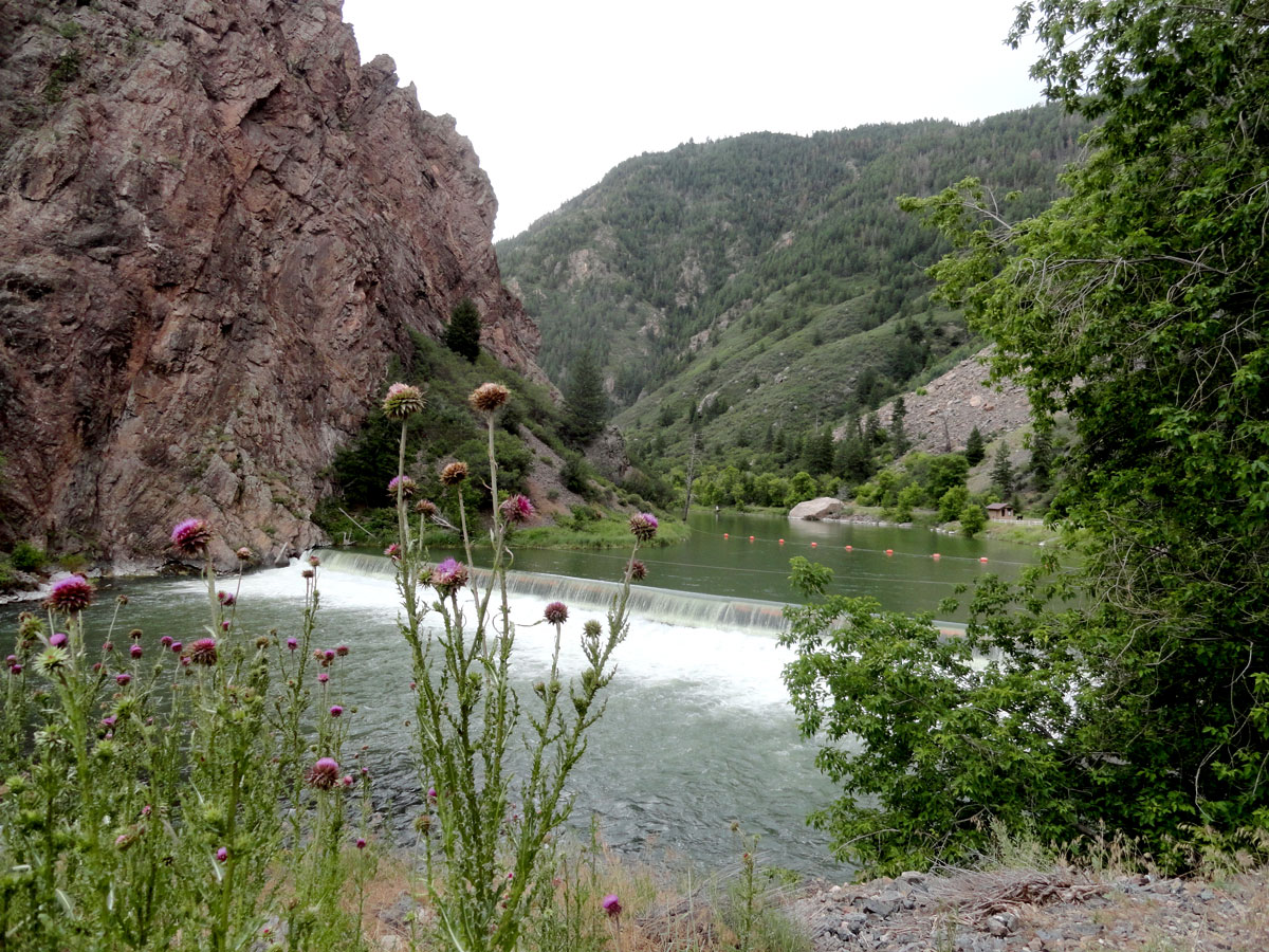
Interstate 70 between Grand Junction and Denver is known as an engineering marvel. It was one of the final sections of the originally planned Interstate Highway System to be completed, the final lanes through Cottonwood Canyon finally being opened to traffic in 1992. For a freeway, it’s a scenic and fairly demanding drive, with constant curves, steep grades and several tunnels. It hugs the Colorado River through narrow canyons for much of the western slope, then starts gaining serious elevation as it passes ski resort towns before crossing the continental divide in the Eisenhower Tunnel under Loveland Pass. At 11,158 feet in elevation and 1.7 miles in length, this is the highest point and the longest mountain tunnel in the Interstate system. After emerging from the east portal it’s all downhill to Denver.

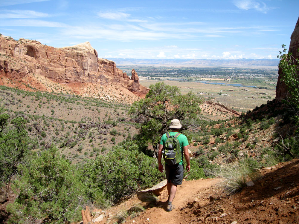
We’ve visited Denver before, so this trip was mostly about re-joining society and meeting up with old friends. We got in some good hiking while in the area, with a steep hike up Mt. Sanitas in Boulder and a long walk through Waterton Canyon near Littleton. We had previously tried to summit Sanitas on our summer 2009 road trip, but had to turn back before reaching the top due to thunderstorms. This time we were successful, climbing the 1.255 foot elevation gain in 1.2 miles and then descending over rocky ledges back down via East Ridge and Sanitas Valley trails. The route is pretty strenuous for a shorter hike, but the views of Boulder, Denver and the Great Plains beyond are amazing. It was a preview of the landscape we’d have to cross to get back to Chicago, and the first level ground we’d seen since entering the Rockies two weeks earlier. Waterton Canyon is well known among mountain bikers in the Denver area because of the trails far in the canyon. For a relaxing hike or bike, a nearly-level 6-mile gravel road winds along the South Platte River in the foothills of the Rockies. Along it, herds of mountain goats graze on the steep slopes and come down to the river for water. We rounded a corner to the sight of 20-some goats standing right in the center of the trail, not bothered by our presence at all, just watching us watch them.

BaconFlight
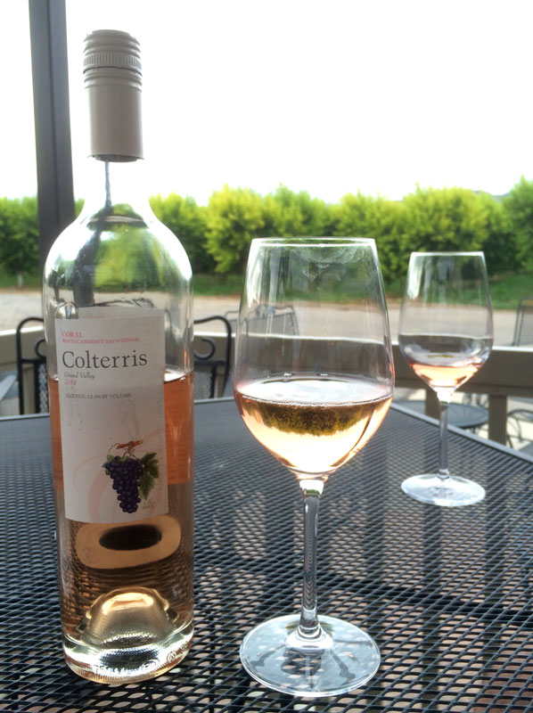
There is always good beer to be had in a Colorado, and our host introduced us to post-hike beers at Cannonball Creek Brewing in Golden. Their outdoor patio is a great place to share a beer with friendly strangers. Our favorite part is that the patio is dog-friendly and nearly everyone there had their pooch with them, including an awesome little Boston Terrier named Tater that we still talk about. We were also eager to get back into the brunch game after so much time in small towns, so we started our three mornings in Denver at Berkshire, Cafe Terracotta and Egg Shell. Most memorable was the Bacon flight at Berkshire, four flavors of meat and fat, prepare yourself. At dinner time, we enjoyed Mexican at Comida at The Source, in the up-and-coming River North district and got our fill of meat at modern chophouse Block & Larder, on Tennyson St. in the Highlands neighborhood.

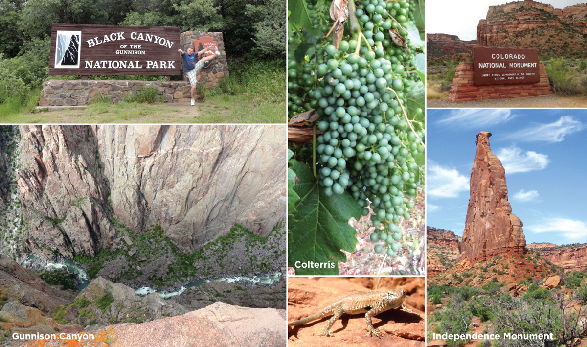
We’ve covered Denver pretty extensively on other road trips, so check out these posts Elevated, Rocky Mountain Highlights, Kick of the Week Denver for further information.

ChimneyRock

Chimney Rock poking out of the Nebraska Plains.


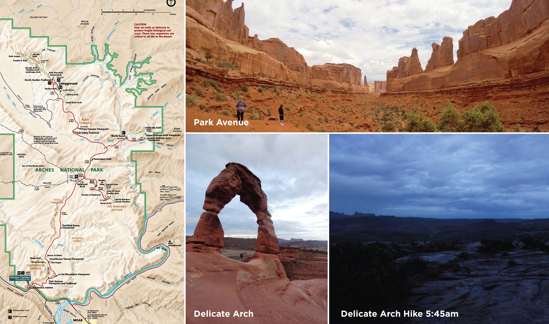
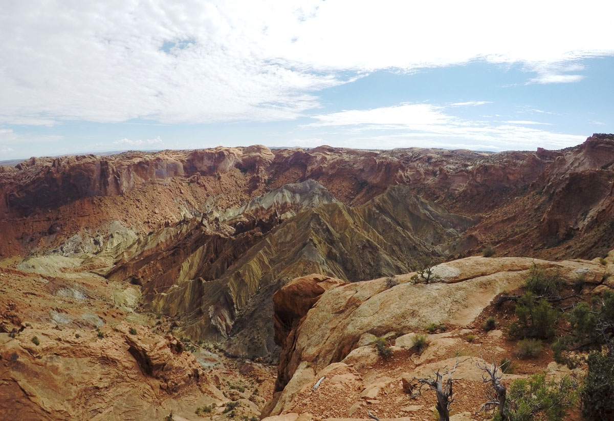
While planning, we debated whether to return to Chicago the fast way, returning across I-80, or to veer north to visit some sites in South Dakota’s Black Hills. Obviously we chose the latter. We realized that on the way up north, we’d be passing some significant Oregon Trail sites, so the route was set. After passing through the southeastern corner of Wyoming, we re-entered Nebraska on a tiny state highway and made our way to Scotts Bluff National Monument, a high bluff of soft sedimentary rocks towering over the North Platte River and the plains. This landmark is the point where native, fur trapper and westward migration trails crossed through the Mitchell Pass. The bluff was called Me-a-pa-te by local tribes, which translates to “hill that is hard to go around”. Legend has it that a fur company clerk named Hiram Scott died near the site in 1828, coining its current name. The visitor center has great displays of artifacts related to western trail travel, and the rangers stationed there can summon the shuttle bus for a ride to the top. The drive passes through the only three road tunnels in the state of Nebraska, so try to contain your excitement. Once at the summit, short trails lead to viewpoints with distant views west to ScottsBluffHikeLaramie Peak and east to Chimney Rock. We took the 1.6 mile Saddle Rock Trail that leads back to the visitor center and parking lot. Another short trail at the bottom allowed us to view some of the original wagon wheel paths of the Oregon Trail. After a lunch of great sandwiches at Cappuccino and Company in the nearby town of Scottsbluff, we went east to Chimney Rock National Historic Site. It’s well-known as one of the most prominent landmarks wagon train travelers came across in Nebraska. This 300-foot tower of Brule clay, volcanic ash and sandstone was visible for days as the wagons slowly passed, reminding emigrants of industrial smokestacks back east. A small interpretive center plays an informative video and has a display of period artifacts and artistic representations of the tower. Moving right along, we made a detour to check out the kitschy roadside attraction that is Carhenge, in Alliance, Nebraska. Enormous vintage autos have been painted gray and arranged in the same configuration as the English original in tribute to the builder’s father. Onward though Nebraska’s panhandle, we realized that anyone who complains that Nebraska is boring has never paid attention to the scenery of the western part of the state. It’s beautiful out there, with rugged bluffs, wooded ravines and even some pine-forested sections. With barely another car in sight, we crossed into South Dakota en route to Hot Springs, on the southern edge of the Black Hills.

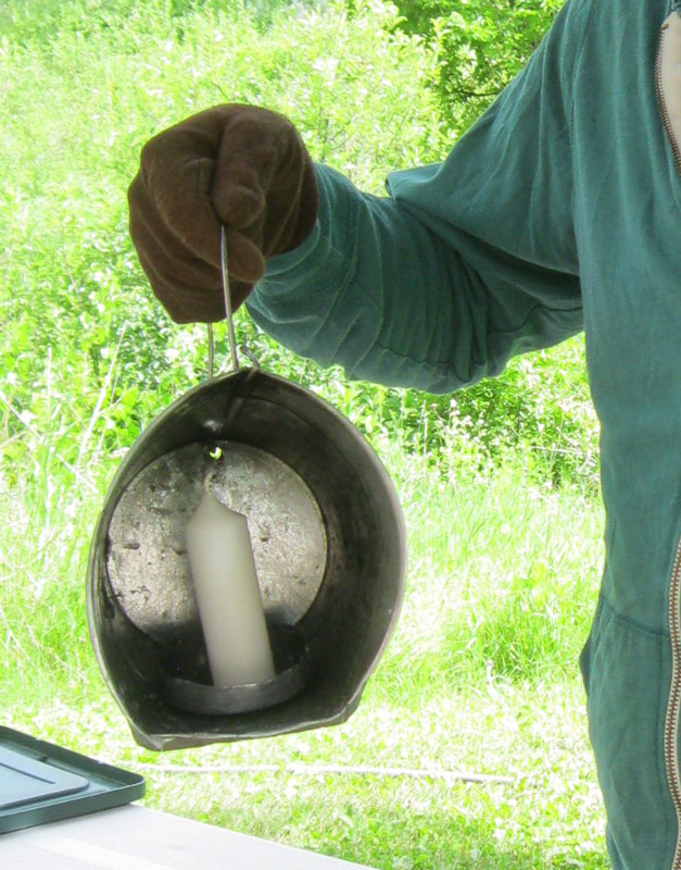
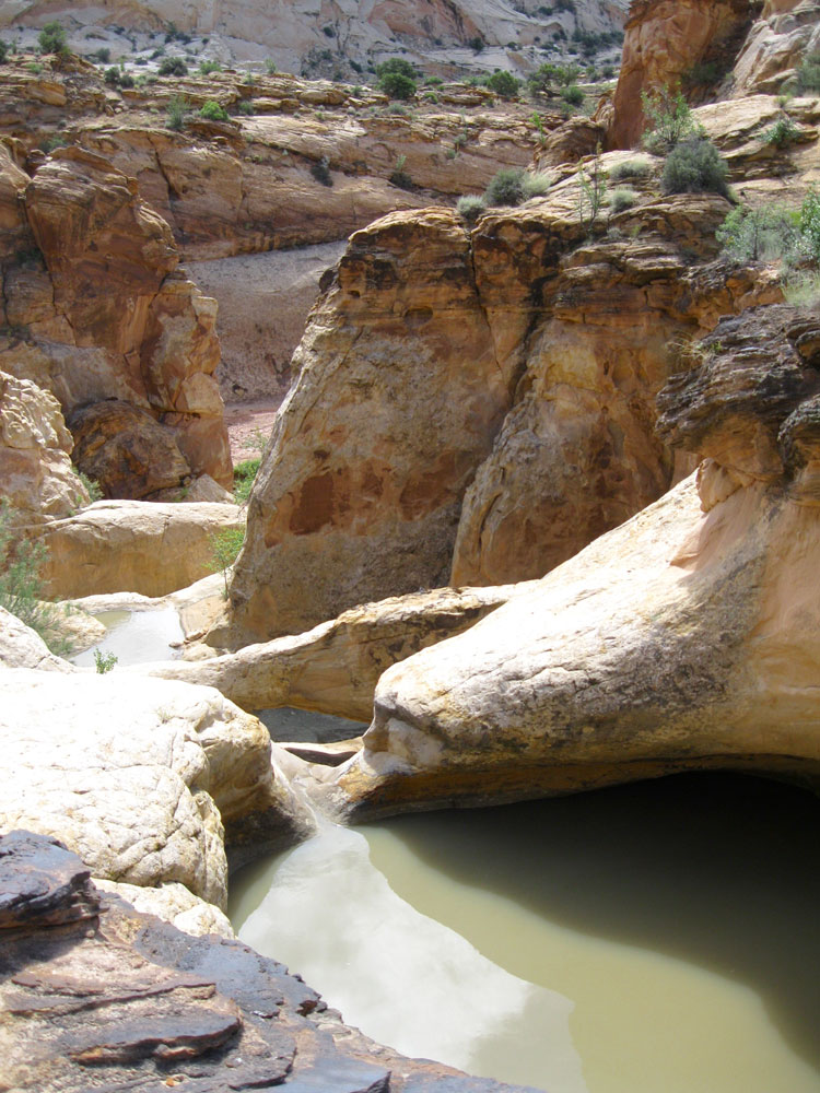
In Summer 2009, before we had developed full-fledged National park fever, we spent time in the Black Hills region and didn’t go to Wind Cave National Park. That error has haunted us for six years, and we needed to make amends, the main reason for our longer route home. Hot Springs is just 15 minutes south of the park, so we booked a stay at the Smith-Fargo Suites hotel downtown. Our Miner’s Suite was large and meticulously decorated, but to be honest the hotel was borderline scary. First of all, we arrived to find the building locked and had to call the owner to let us in. Upon being escorted to our room, we discovered we were the only guests in the entire three-story building. Also, there was an old woman mannequin standing at the end of the hallway. We survived the night without being ax murdered, but wouldn’t recommend the hotel for the faint-of-heart unless it’s a busier evening. The following morning we entered Wind Cave National Park where we had booked a 10:00am tour. This park protects the world’s sixth-largest known CandleBucketcave system and the bison-filled landscape above. It is the seventh-oldest park in the system, created in 1903. There are many different options for cave tours, but after taking lantern tours at Jewel Cave and Mammoth Cave, for us electric lighting is no way to experience a cavern, so we selected the Candlelight Tour. Reservations for this tour are strongly recommended, and can be made up to a month in advance by calling the visitor center. Our guide was great, and our small group of 10 was much more appealing than the groups of up to 40 that were on their way to the Natural Entrance Tour. The 2-hour, 2/3-mile candlelight tour costs $12 for adults and allows guests to experience the cave the same way the original explorers and mappers did in the 1890s. For our only light source, each group member is issued a metal bucket converted into a lantern, just like the old times. In the farthest depths of the route, our guide stopped to tell a Native American origin story and had us blow out our candles one by one until we were sitting in complete darkness and silence, a rare treat for anyone. Back on the surface, we drove through the rest of the park, stopped for lunch at the Blue Bell Lodge in Custer State Park and passed by Rapid City on our way to the eighth and final national park of the summer.

WesternBadlands

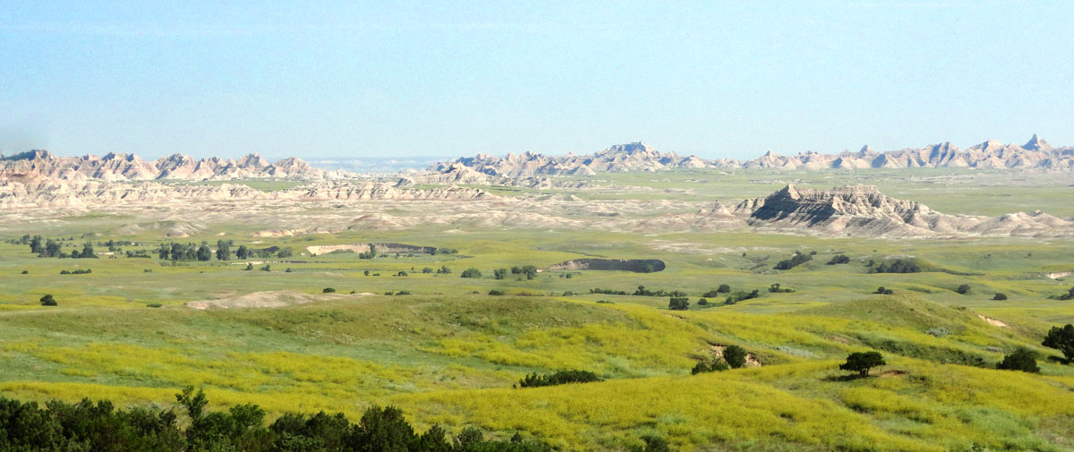
Badlands Scenery along Sage Creek Road.

Photographing the wildlife of Badlands.

Photographing the wildlife of Badlands.

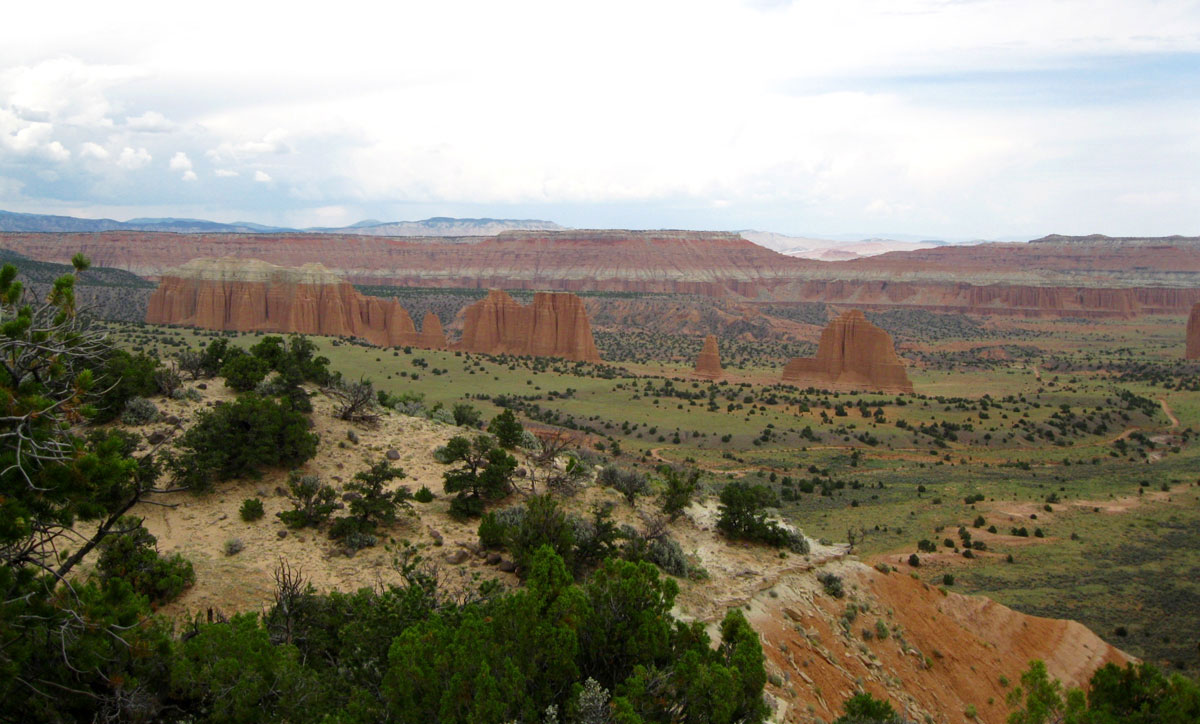
On that previously-mentioned 2009 drive, we made our first national park visit together, to Badlands. Six years later, with our current park total at 38, we came full-circle by entering the park’s western edge along Sage Creek Road. This 25-mile gravel stretch is away from the main scenic drive and not as dramatic, but very beautiful nonetheless, with giant bison herds and prairie dog towns along the way. We met up with the main Badlands Loop Road and drove it in reverse of our first visit, traveling leisurely west to east, before exiting the park and merging onto I-90 toward home. We spent that evening eating Arby’s in a worn out Days Inn in Oacoma. After not resorting to fast food for nearly 3,900 miles, we finally gave in when the glowing orange hat was the only restaurant in town still lit. The next morning we looked at the Mitchell Corn Palace, mostly because we think you’re just supposed to, and then finished off the rest of South Dakota at 85 miles per hour. There was one more highlight to look forward to that day, the Lewis and Clark Interpretive Center in Sioux City, Iowa and the nearby Sergeant Floyd Memorial. We rarely travel without crossing paths with our buds Lewis and Clark, and the Sioux City museum is a really great place to learn about their journey. The Floyd Memorial is a large obelisk on a bluff overlooking the Missouri River south of town, where the only casualty of the expedition is buried. Five hours later, across the impossibly green, rolling fields of Iowa, a home-cooked meal was waiting for us in Dubuque, our last stop before Chicago.

In total, we drove 4,572.3 miles on Interstates, 2-lane highways, country roads, gravel roads, and dirt paths while averaging 48 miles per hour and 40 miles per gallon. We took a ferry, forded a stream in a Jeep and even saw the sun rise one day. We also slid down sand dunes, climbed ladders and hiked 53 miles on foot, but still managed to gain weight, probably through our love of beer and good food. We were welcomed to 10 states, 8 national parks, 5 national monuments and countless historical sites. We still can’t think of a better way to see the country.

Our plans for spring break and summer 2016 are already in the concept and planning stages, so stay in touch to see where we appear next!

Posted in Destinations, Travel Tips | Tagged , , , , , , , , , , , | Leave a comment

Western Parks Part 7: Gunnison and Grand Junction

Part7

Our sixth national park of the trip, Black Canyon of the Gunnison, took us back into Colorado. To get there we decided to take a slightly longer but more scenic route. Instead of going north out of Moab to catch Interstate 70 to Grand Junction, we went south on US 191 and turned east on Utah 46 to skirt the scenic La Sal Mountains that had defined our eastern skyline for the past few days. This route meant we crossed into Colorado on a rather lonely stretch of roadway with beautiful surroundings. We wound our way through a broad valley between the Uncompaghre Plateau and the San Juan Mountains, turning north toward Montrose at the quaint-looking town of Ridgway. On a sad note, after more than 37,000 miles and 8 years of road tripping, we had our first roadkill incident along Colorado Highway 90 … sorry Mr. Ground Squirrel. Our arrival into Montrose brought the first sighting of suburban sprawl, strip malls and chain stores we’d seen in 11 days, and its population of 19,000 felt like a city in comparison to where we’d been. We were just getting the first hints of our civilization re-entry sequence. A quick TripAdvisor check led us to Horsefly Brewing for lunch. The quality of the beer and food belies the building’s apparent past life as a KFC franchise. The Highland Scottish was particularly good and there was no “Double Down” sandwich to be found on the menu.

Black Canyon of the Gunnison from the Oak Flat Loop Trail.

Black Canyon of the Gunnison from the Oak Flat Loop Trail.

The Black Canyon of the Gunnison entrance station lies about 20 minutes northeast of Montrose after a long uphill climb. The park preserves the most scenic and dramatic 12 miles of the 48-mile long canyon carved through the Gunnison Uplift by the Gunnison River. Being off the beaten path and the 9th smallest national park by area, it is lesser known than the big Utah units we had come from. It was designated a National Park in 1999 after being a National Monument since 1933. The 2,000-foot deep canyon is notable for the extreme steepness of its walls and the name Black Canyon comes from the fact that parts of the deepest portion only receive about a half hour of direct sunlight a day. The steep canyon walls are due to the hardness of the rock the river is cutting through; they don’t easily crumble and widen the canyon horizontally like at Canyonlands. When the fast-moving Gunnison river got trapped in its current course after carving through softer volcanic rock, it began cutting straight down through layers of hard schist and gneiss at the rate of about an inch every 100 years. It’s a startling realization to note that you’re looking at the results of 2 million years of work. Today the Gunnison descends at an average rate of 34 feet per mile, one of the steepest rivers in North America. For comparison, the Colorado river drops about 7.5 feet per mile through the Grand Canyon. Standing at the rim, you can hear the water furiously rushing way down below, slowly deepening the channel. This source of water provided the motivation for the cultural aspect of the park. In 1901, the US Geologic Survey sent two men down the river to scout a suitable location for a diversion dam and irrigation tunnel to send water to the dry Uncompaghre Valley (around the town of Montrose) to develop agriculture. Earlier expeditions down the Gunnison had been disasters, but this attempt survived largely due to to their use of inflatable rafts rather than wooden boats, yikes. Their journey is covered extensively in the visitor center. Because of their findings, by 1909 the dam and a 5.8 mile tunnel were completed, helping to turn Montrose into an agricultural hub.

BlackCanyon

Just outside the South Rim Visitor Center, we hiked the 2-mile Oak Flat Loop Trail, that leads 400 vertical feet down along the canyon rim. That’s as far as you can go down unless you get a special backcountry permit to hike the inner canyon. Beyond a marked gate on the Oak Flat trail there are no maintained routes, just steep, rocky ravines descending into the depths. Anyone attempting this is expected to be in excellent physical condition, find their own way and be able to “self-rescue” in the event of trouble. There’s even a warning that due to the extreme terrain, some hikers who fell or became severely injured were never able to be “recovered”… so that little nugget should discourage most people from venturing in there.

The main park attraction is the scenic 7-mile South Rim Road and its vistas. Numerous lookout points are marked alongside the road, some with short trails that lead to spectacular views of the canyon and river. Gunnison Point, at the visitor center offered our first view of the water raging below. Down the road, Chasm View lookout is near the narrowest point where the North Rim is just 1,300 feet away. It feels as if you could throw a rock to the other side, but it would take more than two hours of driving to get there. The coolest view is probably at Painted Wall View, where Colorado’s highest cliff stands on the opposite side. It’s a sheer 2,250 foot wall of gray rock, with streaks of pinkish volcanic stone cutting through it.

Gunnison Diversion Dam

The historic Gunnison Diversion Dam.

At the end of South Rim Road at High Point, a 1.5-mile round trip trail leads to an overlook at Warner Point, but unfortunately once again there were storm clouds gathering and thunder rumbling nearby, so we thought it best to skip that and instead headed to the one place where you can access the canyon depths easily. Just inside the entrance station, a turn onto East Portal Road allows cars down to the river at the location of the historic Gunnison Diversion Dam and tunnel. The road plummets 1,966 feet over the course of 2.5 miles, twisting through hairpin turns the whole way. Our brakes smelled like a barbecue by the time we reached the bottom, even after crawling down slowly in 1st and 2nd gears. The perspective offered by looking up from the floor of the canyon is worth the trip, and we got to see the much talked-about diversion dam and the entrance building to the irrigation tunnel. After returning to the rim, we thought about making another attempt at Warner Point, but the weather was still threatening and sprinkles were falling, so we left the park and pointed toward our overnight stopping point, Grand Junction, Colorado.

Descending through Wedding Canyon.

Descending through Wedding Canyon.

Our main motivation for stopping in Grand Junction was Colorado National Monument, which lies along the western edge of the city. We started our visit in the morning by hiking Monument Canyon Trail. The east trailhead starts strangely amongst suburban subdivisions, even passing just along the edge of people’s back yards before climbing gradually up a scenic canyon. About 2.5 miles in, the trail reaches the base of Independence Monument, a tall, thin remnant of a wall of rock that has been mostly eroded away. From this vantage point the high walls and other formations like the Kissing Couple tower overhead. The visitor center can also be seen clinging to the edge of the rim above to the north. The Monument Canyon Trail continues a further 3.5 miles and 600 feet up to the western trailhead along the scenic drive, but without a way to get back to the car, we instead made a loop by returning to our starting point via the unmaintained Wedding Canyon trail. Though it’s listed as “unmaintained” we found it easy to follow, and we always prefer seeing new scenery to doubling back on a trail. Hungry after the 5 mile hike, we stopped in the cute town of Fruita for a picnic lunch packed by Camilla’s Kaffe. Food in hand, we entered the scenic drive and passed through the double tunnels on the way to the top of the plateau. Between the finish of our hike and arrival at the visitor center with lunch, yet another pesky thunderstorm had popped up, blocking out the sun and rumbling ominously. We ate under a picnic shelter and watched the visitor center movie before continuing south along Rim Rock Drive. From viewpoints along this scenic road, we got the reverse view of our morning hike, looking down on the monuments and canyons instead of up from within. Monument Canyon View allowed us an overview of nearly our entire route, while the Coke Ovens Overlook provided a view of the mound-shaped rocks resembling industrial machinery. Further south along the scenic drive there are fewer prominent formations, but many sweeping views of red-walled valleys, before descending steeply to the east entrance. With the size and impressiveness of the monument, you may wonder why it’s not designated a national park. In fact, groups have been pushing for a status change intermittently for the past 100 years. A 2014 effort by members of Colorado’s congressional delegation proposed it becoming our 60th park and possibly being renamed Rim Rock Canyons National Park. Stay tuned, we may see this effort pass one of these years.

ColoradoMonument
Formations of Colorado National Monument. Independence Monument is at center left, brooding skies are above.

In early planning, our Grand Junction experience was going to be a quick drive-through on our way to Gunnison, but after learning of Colorado National Monument and area breweries and vineyards, we slightly re-routed our trip (taking the previously-mentioned southerly entrance into Colorado). We decided we would first visit Gunnison and then stay two nights in Grand Junction to explore the area. Hotel opportunities also played a part. Had we passed through Grand Junction, it would have put us overnight in Montrose, where there aren’t nearly as many hotels and restaurants. Our lodging for two nights was the Palomino Inn on the North Avenue strip. Grand Junction offers the standard list of chain hotels along Interstate 70 and some downtown options, but the Palomino has that independent motel vibe we enjoy. Additionally, it’s about half the price of the national chains, has more comfortable rooms and provided the best continental breakfast of our trip.

On the drive from Black Canyon, Nick searched for dinner options online. We were in the mood for some urban dining after our mostly rustic recent restaurant experiences, and found it at Bin 707 Food Bar downtown. Local specialties like Colorado lamb tenderloin highlight the dinner menu and a wide selection of creative cocktails and an extensive wine list is available. On our second night in town for dinner we went for Italian at il Bistro Italiano. There was a bit of a wait due to the lively Thursday farmers market happening on Main Street, but we killed the time browsing a nearby book shop. It was well worth the wait for the homemade bread and pasta and the unique takes on traditional Italian dishes.

ColterrisCoralWhiteBefore this trip, we were only vaguely aware of the existence of a Colorado wine country. Consisting of 50 square miles near Grand Junction, it is known as the Grand Valley AVA (wine region) and was established in 1991. A week earlier in Mesa Verde’s Metate Room we wanted to try a Colorado wine with dinner, so our server recommended a bottle from Colterris Wines. The vineyard is located just east of Grand Junction on a mesa overlooking the Colorado River near the town of Palisade, so we had to check it out. It’s only a 20 minute drive from the Palomino Inn, so right after returning from the national monument, we freshened up and headed over for some tastings. The grounds are beautiful, and there’s a store attached where you can sample and buy their fruit as well. We especially enjoyed the unique Coral White Cabernet Sauvignon, which is a white wine made from red grapes that has the color of a rosé. We bought a bottle to enjoy while watching storm clouds brew. Speaking of which, there is also a healthy amount of brewing going on in the Grand Junction region. After Colterris, we stopped by Palisade Brewing to check out the local beer scene. We were very happy with our findings, and enjoyed a couple pints in the metal shed-turned-brewery while rain poured down outside.

On our last morning in Grand Junction we stopped by Allen Unique Autos, a large car collection owned by a local businesswoman. It’s a quirky gathering of historic cars uniquely (tackily) displayed, but we had an hour to kill, so it was entertaining. We then  proceeded east toward Denver, happy in our perfectly normal car.

Posted in Destinations, Travel Tips | Tagged , , , , , , , | Leave a comment

Western Parks Part 6: Arches

Part6

Continued from Part 1Part 2Part 3Part 4, Part 5

Tuesday, July 7th we planned an exceptionally full day in Arches National Park. Upon arrival in Moab two days earlier we stopped at the Arches visitor center (because it’s right off the highway) to check availability of tours of the Fiery Furnace area. We had also read that the famous Delicate Arch is crowded during peak season, especially at sunset, so we asked about the timing for a sunrise hike. The ranger said that was a great time to be there, and that with sunrise around 6:05, we should begin the hour-long hike at 5:00 and thus enter the park at 4:30am. Woah.

There’s not much that gets us up that early, but every one of our national park trips seems to have at least one day where we end up awake pre-dawn. The sound of an alarm at 4:15am is never a pleasant one, but with such an exciting sight ahead of us, we sprang into action fairly easily. We had packed the night before, so all we had to do was throw our hiking clothes on, grab our backpacks and head out. Nick opened the hotel room door and reported “It’s raining.” Crap. And it wasn’t just a tiny drizzle, it was a pretty steady rain. We briefly debated on weather or not to continue, but decided we might as well go ahead with it because who knows when we’ll be back in Moab. Really our main concern was lightning, so kept an eye on the weather radar as we drove to the park entrance to see if there were any storms forming or if this was going to be a rain-only event. The last place you want to be with a chance of lightning is a trail on an exposed rock ridge an hour’s hike from the car. It continued to be just a light rain, so we entered the park. It’s a strange feeling to be in a popular place when there are no other visitors. We drove the 13.2 miles to Delicate Arch trailhead at Wolfe Ranch in pitch blackness. We only saw the vague outlines of towering formations against the stars in the sky. The headlights lit red rock everywhere along the edge of the pavement, but we really had no idea of the scenery we were driving through. When we arrived at the parking area we were alone, but one more car arrived a couple minutes later. We were slightly relieved that at least two other people were crazy enough to be there at this hour. We studied the map at the trailhead under our phone flashlights and then set out into the darkness.

DelicateArchBowl

It’s a little unnerving to be following a dark trail you’ve never hiked before, but it was well enough marked that we were fairly certain we were going the correct direction. The trail begins to climb up a ridge of slick rock shortly after leaving the parking lot, at which point we turned around and saw a few more sets of headlights coming down the road toward the parking area. There was still a drizzle coming down, but it was tolerable and our hiking hats kept the water off our heads. It’s important to remember that even in the desert where daytime temperatures can be over 100 degrees, mornings can be quite chilly. It’s a 1.5 mile hike to the arch, with 480 feet of elevation gain. We’d put it in the moderately difficult category, but at 5:00 in the morning everything takes a bit more effort than normal. Toward the top, the rain stopped and a dawn glow was filtering through the clouds, finally revealing our surroundings. After climbing a smooth expanse of rock for most of the route, the trail threads between some rock fins, briefly hugs the edge of a ledge and then rounds a corner to reveal Delicate Arch dead ahead. Boom. This 65-foot arch is perhaps the most recognized symbol of Utah and one of the most iconic singular features of the American West, and we had it nearly to ourselves. The arch sits between the edge of a giant rock bluff and a bowl-shaped depression. Wandering around allowed us to appreciate the arch from all angles. We stayed for just over an hour to watch as the changing light and clouds altered the scene. On the hike back to the parking lot we finally saw the real landscape of the park that we had driven and walked through in the dark hours earlier. Other than Nick’s ankle roll with just a few hundred yards left, our morning adventure was a great success.


DevilsGardenNeil

Hiking through Devil’s Garden.

The area of the park with the highest concentration of prominent arches is the Devil’s Garden, located at the northern end of the road system. There are 7.2 total miles of trails in this area, the longest hike in the park if you do the whole thing. From the parking area a trail sets off between two tall sandstone fins. The main trail is an out-and-back route with shorter side trails leading to arch viewpoints and a primitive trail that creates a loop at the far end. The first mile between the trailhead and Landscape Arch is fairly level and has spur routes to Tunnel Arch and Pine Tree Arch, both are worth checking out. Landscape Arch up ahead is probably the second most famous arch after Delicate, as it is LandscapeArchmost improbable looking of all the arches. This 290 foot span of rock is only 9 feet thick at its thinnest point, making it appear that it could collapse at any moment. In fact, visitors have not been allowed to hike below it since a 70-foot section of rock peeled off its underside in 1991. Get your ass to Utah while it’s still standing. After Landscape Arch, the trail climbs along the edge of a thin fin of rock to a fork in the road. Continuing straight leads to Double O Arch and Dark Angel, but we turned off to the left to visit Navajo Arch and Partition Arch, both of which you can walk right up to. Standing inside Partition offers a great view down over the fins to the valley below.

PartitionArch

The view though Partition Arch.

Double Arch

Double Arch

After a return to Moab for lunch at Eklecticafe and an Ace bandage for Nick’s ankle, we drove back for more arch viewing. When we arrived in Moab we stopped at the visitor center to reserve tickets for the ranger-guided tour of the Fiery Furnace. Morning tours can be reserved online months ahead of time, but afternoon tours are first-come, first-serve up to a week in advance. They had availability on the 5:00pm tour this day, so we bought them ($10 per ticket). We had a few hours before we needed to meet the ranger, so we visited Balanced Rock (no explanation needed) and the Windows Section. Windows is named for the North and South window arches that look out over the landscape and contains enormous, rounded cliffs of rock that appear alternatively like they’ve been melted or like animals. One formation is actually called Elephants on Parade. Both window arches and the nearby Turret Arch are large and impressive, but our favorite arch in this area was Double Arch, with its two giant rock spans towering over a hollowed out section of the cliff. A trail leads right up inside, it’s kind of like sitting inside an enormous porch with a skylight.

Ranger Matt leading the way.

Ranger Matt leading the way.

Approaching 5:00, we took off for our Fiery Furnace tour. This is an area that is not open to the public because it is basically a big confusing maze of rock fins with narrow passages in between. To avoid lost tourists, the park only allows entry to guests with tickets and the accompaniment of a park ranger (or by special permit). It’s really a win-win situation because it means the group sizes are limited to about 20 people at at a time and you get full narration and interpretation along with it. Ranger Matt gave us some tips on what to expect and warned people of how strenuous the hike would be. It’s really not too difficult, but there are a few sections where you need to do a bit of scrambling on rocks through narrow spaces, so they’re really just trying to scare away anyone who might pose a freak-out risk. After a brief downhill walk from the parking area, we entered the first of many narrow slots with completely vertical walls and topped by strange fins and spires. Ranger Matt had a wealth of knowledge to share about the geologic processes that formed this area, as well as plant RockScramblingand animal residents and various other topics of interest. The two hours spent in the Fiery Furnace were memorable and informative, we highly recommend it for anyone visiting Arches. We were extremely lucky with weather, as the region normally has highs in the upper 90s or 100s in early July, but the cold front that dumped the morning rain showers held the day’s high to an unseasonably cool low 80s. Afternoon tours in 100 degree weather must be nearly intolerable.

From sunrise to sunset, in rain and sunshine, Arches blew us away. It’s no wonder it’s a favorite of National Park visitors and marked an attendance high in 2014 with nearly 1.3 million guests.

Up Next: Black Canyon of the Gunnison

Posted in Destinations, Travel Tips | Tagged , , , , , , , | Leave a comment

Western Parks Part 5: Canyonlands

Part5

Continued from Part 1Part 2Part 3, Part 4

After Capitol Reef, we drove a comparatively uneventful 2.5 hours east to Moab, Utah, our base for exploring Arches and Canyonlands National Parks. With about 6,000 residents, Moab was the largest town we’d seen since passing through Durango, Colorado five days earlier, it was positively bustling in comparison to Mexican Hat and Torrey. It is a tourism hot spot, known for mountain biking, Jeep off-roading, and any outdoor activity you can think of. Moab is also home to one of our favorite lodgings of the trip, Inca Inn. When in far off places we always love a good “mom & pop” motel and this one didn’t disappoint. The free breakfast and outdoor pool were nice, but they also thought of the little things that matter when traveling, like outlets. Why don’t more hotels just install 6-outlet adapters? Finally we didn’t have to climb under tables of move the bed to charge our many electronic devices we use during the day. They also get bonus points for installing disco LED shower heads, a random and fun surprise. Since we arrived in mid-afternoon and hadn’t had lunch because of a large breakfast at the Rim Rock Inn restaurant, we just needed a little  something to eat, so headed to Peace Tree Juice Cafe for a light lunch and smoothies, the Desert Nectar was amazing.

With three nights booked at the Inca Inn, we decided it best to spend a full day in each national park and visit nearby Dead Horse Point State Park on this first evening in town. Dead Horse is a small but spectacular point of land overlooking the Colorado river just upstream from the more famous Canyonlands National Park. It’s about 40 minutes from Moab along the same route that leads to Canyonlands. Dead Horse Point is a great preview to the area landscape and geology, being kind of a mini version of the enormous Island in the Sky district of the national park visible across a canyon to the west. The park is popular with mountain bikers and has several miles of hiking trails, but we stuck to the short trails to viewpoints with our limited time before the sun went down. On the way to the tip of the park, the road crosses a neck of land that is barely wider than the road itself. The tip of Dead Horse Point offers nearly 360 degree views into the never-ending landscape of layered red rock. One important note is that the Colorado River is visible from most of the park’s vantage points, while it is hidden from view in a deep crevasse from Canyonlands. The whole area bears a resemblance to the Grand Canyon, so it’s no surprise that the famous flying car scene from the 1992 movie Thelma and Lousie was filmed here, rather than Arizona. Apparently it’s easier to get permission to drive a car off a cliff in a state park than a national park. Back in Moab, we enjoyed dinner at Moab Brewing, but were again confounded by those western state booze laws. Beer brewed by a brewery/restaurant and served it its very own building can’t be above 3.2%, but they are allowed to can the more potent version of the same beers and sell them from a separate kiosk in the front of the store. Just plan on being sober in Utah.

Upheaval Dome viewed from the overlook trail.

Upheaval Dome viewed from the overlook trail.

The next day was our full day dedicated to Canyonlands National Park. This park is  fairly undeveloped, with only a small visitor center near the entrance and no food services. You can fill your water bottles at the visitor center, but plan to pack in a picnic. We did some research and found the Love Muffin Cafe in town opens early and makes great lunches to go. Canyonlands is an enormous park by area, the largest one we’d visit on this trip, but receives less than half as many visitors as Arches right next door so there’s never a crowd. There are three main sections of the park to consider, Island in the Sky, The Needles and The Maze. The different districts are separated by rivers and thus not connected by road or trail, so visiting more than one realistically requires more than one day. We spent our time at Island in the Sky, the most accessible and popular section. It is a large flat plateau rising up to 2,200 feet above the Colorado and Green Rivers with a maze of river-carved canyons, cliffs, buttes, fins and spires as far as you can see in every direction. We started with the introductory movie and some ranger advice at the visitor center. Our first stop was the crazy geologic feature called Upheaval Dome, a 3 mile wide circular remnant of a meteor impact about 12 miles inside the park entrance. Centuries of erosion have exposed layers of upturned rock radiating out from the center. The 8.4 mile Syncline Loop Trail circumnavigates the formation and allows access into its center. The trail sounds awesome, but it is primitive and unmaintained with some pretty intense elevation changes and boulder scrambling. Combine that with a July temperature in the 90s and the complete lack of shade, and we knew it wasn’t meant to be. We instead kept our hiking to the Upheaval Dome overlook trail, a 2 mile round trip that leads to two spectacular viewpoints above the crater. Even after this shorter, less strenuous hike we were sweaty messes because of the intense sun. In the summer months, several short hikes is a good way to go, with air conditioned car rides in between viewpoints to cool off. A spring or fall visit would allow longer trail excursions.

GrandViewPoint

View from Grand View Point, the tip of Island in the Sky.

Next down the road we hit the Green River Overlook viewpoint, which probably has the most classic Canyonlands views in the area. The Green River is visible far below, as well as many of the park’s rock formations and even the Henry Mountains more than 50 miles distant. There’s no hiking here, but it’s a great place for photos. Continuing to the south along Grand View Point Road takes you along the increasingly narrow finger of land until you reach Grand View Point, where Island in the Sky basically hits a dead end. We parked at the end of the road and continued on foot along the Grand View Point Trail to the very tip of the plateau, where we stood on a rock with sheer 1,200 foot cliffs on all sides. At this point, the immense scale of the park is most apparent. The Needles district is visible in the distance, but it would take more than two hours to get there by car. The Maze district is also over there somewhere, but it’s so inaccessible I don’t even know how long it takes to get there.

Heading back toward the park entrance, we stopped for our picnic lunch under the shade structures just north of Grand View. Feeling replenished we had two more sites to visit before returning to Moab. Mesa Arch is a Canyonlands must-see. An easy quarter mile walk leads to the wide natural arch that frames views of jagged canyons, Washerwoman Arch and the distant LaSal Mountains. It’s especially popular with photographers in the morning as the rising sun reflects an intense orange glow along its underside. Further along, the Shafer Canyon Overlook gave us the reverse view of what we had seen the previous day, with Dead Horse Point visible across the canyon. Those in four wheel drive vehicles can take the unpaved Shafer Canyon Road back to Moab from near here, but we’d subjected the little Mazda3 to enough off-roading already and took the normal route back to Moab. Canyon lands is really a park that is worthy of multiple days or future visits, the strange mazes of never-ending canyons never get old. We could return and go to the Needles and have a completely different experience than we had at Island in the Sky.

MesaArchView

The view through Mesa Arch, Island in the Sky district.

Reaching the mid-point of the trip, we knew we’d be in need of fresh clothes, an important packing consideration when traveling for more than a couple weeks. A pre-departure google search led us to Moab Laundry Express, with two locations in town and giant machines that can wash a couple weeks worth of clothes in one load. An exceptionally friendly local provided advice on appropriate settings (the high heat dryer setting is WAY TOO HOT), and we left all freshened for the next week and a half.

JeffreysManhattanThat evening we treated ourselves to dinner at one of the more upscale restaurants in Moab, Jeffrey’s Steakhouse. Located in a historic stone house a block off the busy tourist main street, Jeffrey’s offers a wide variety of modern dishes and a full wine and cocktail list. Their specialty is American Waygu Beef sourced from a Nebraska farm. Everything we had was delicious, the service was top notch and they’re conveniently on Opentable for easy reservations. After dinner we climbed the stairs and finished off the evening with cocktails in the attic Ghost Bar, a tiny lounge serving classic cocktails and wine. We made it an early night as we had some pre-dawn plans in Arches National Park, but left Jeffrey’s fat and satisfied at finally having found some worthy Utah cocktails.

Up Next: Arches National Park

Posted in Maps | 1 Comment

Western Parks Part 4: Capitol Reef

Part4

Continued from Part 1, Part 2, Part 3

Capitol Reef National Park is one of those places that is tough to get a mental grip on. The variety of rock formations is staggering, each one stranger than the next. Look one direction and you’ll see towering vertical cliffs, look the other and you’ll be staring into a deep canyon and then just a mile ahead there will be an entire landscape tilted at a 45 degree angle. The briefest possible geologic explanation: Sediment was laid down here in layers over millions of years, eventually building up and creating rocks with varying consistencies, textures and colors. Then the whole area underwent uneven uplift, causing the surface to fold into a giant horizontal S-curve. Millions of years of erosion have since worn away the upper layers and shaped the rock into the current landscape.

We’re happy we did our research ahead of time, because seeing only what is visible from the park’s scenic drive or from Utah 24 as it passes through the waterpocket fold would have left us with an incomplete picture. That’s what led us to entering the long way via the Burr Trail the previous day. Our reading also pointed us to the northern extremes of Capitol Reef, to an area known as Cathedral Valley, a remote region filled with monoliths, canyons and formations that few dare to visit. The 62-mile Cathedral Valley Loop Road provides backcountry access, but only with the appropriate off-road machine. Enter the folks at Thousand Lakes RV Park who will gladly rent you a Jeep by the day for a reasonable price. We picked up our jacked-up, white 2011 Jeep Wrangler, and armed with Treada map from the park rangers, exited Highway 24 twelve miles east of the visitor center where we were instructed to ford the Fremont River. When they said “ford a river” we pictured splashing through a gentle stream, but they weren’t kidding. To cross, you enter the 18-inch-deep river, drive along it downstream for about 50 yards and then hang a left and power up the muddy bank on the other side. Suddenly the monster truck we were driving didn’t seem like overkill at all.

Lower South Desert overlook.

Lower South Desert overlook.

The loop is alternatively soft and sandy or rough and rocky, and it crosses countless steep-sided washes (dry creek beds). In places it can be challenging to navigate for novice off-readers but it’s also a blast to do. Some sections were so rutted and washboarded that we had to slow to a crawl for miles at a time for fear of shaking the Jeep to pieces. Spur roads lead to short hiking trails to panoramic viewpoints at Lower South Desert, Upper South Desert and Upper Cathedral Valley. At about the halfway point there is a campground where we stopped to have our picnic lunch. Being a campground, we expected to encounter other visitors, but it was completely deserted and we ate our Subway sandwiches with a soundtrack provided by distantly rumbling storm clouds. After the campground, the trail descends from a high ridge to the floor of the Cathedral Valley, where we were dwarfed by towering sandstone monoliths that look like art deco buildings. There we took side visits to Gypsum Sinkhole, where eroding gypsum has created a 200-foot-deep hole, and then to the Temples of the Sun and Moon, two giant rock formations standing alone in a valley. The route emerges back onto Utah 24 at Caineville, five miles east of where we had started in the morning. All in all, the drive took 6.5 hours, which averages to about 12-15 miles per hour. We passed a total of two cars the entire time, including one couple who had no map and were eager to find out where the nearest paved road was (luckily for them, we were only about two minutes from the highway at that point). It’s pretty cool to think that we were maybe two of six people who visited Cathedral Valley that day. We hosed the mud off the Jeep at the Torrey car wash as instructed and picked up the Mazda from its day of rest and promised it no more unpaved roads (we’d prove to be liars). That evening gave us a chance to try the more upscale Rim Rock Restaurant at our lodge. I was served the largest plate of ribs I’ve ever seen and our waitress was as friendly as they come. It reminded us how convenient it is to have on-site dining options when staying in remote locales, saving us an additional drive into town.

CathedralValley

Cathedral Valley viewed from the Upper Cathedral Valley Overlook.

We saved the more-traveled scenic drive section of the park for our final morning in Capitol Reef. The visitor center is in the area of the historic town of Fruita, where pioneer families tended orchards in a peaceful settlement between red cliffs. You can still walk into the orchards and pick fruit if you would like. Continuing on the 8-mile scenic drive along the west side of the waterpocket fold leads to numerous viewpoints and trailheads. At the end, we took the muddy side road to Capitol Gorge and did a 2.2 mile out-and-back hike through the twisting, narrow canyon. About a mile in, a steep path climbs up the rock wall of the canyon to a series of pools filling bowl-like depressions in the rock. This is the type of formation that gives the name “waterpocket” to this “fold” in the Earth’s crust. Now it all made sense.

Up Next: Canyonlands and Arches

CapitolGorge

Hiking through Capitol Gorge.

Waterpocket

Waterpockets at the end of the trail.

Posted in Destinations, Maps, Travel Tips | Tagged , , , , | 2 Comments